Ten Boer
Ten Boer (Dutch pronunciation: [tɛn ˈbuːr] (![]()
Ten Boer | |
|---|---|
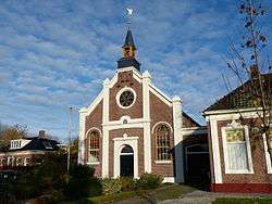 Church in Thesinge | |
 Flag Coat of arms | |
.svg.png) Location in Groningen | |
| Coordinates: 53°17′N 6°42′E | |
| Country | Netherlands |
| Province | Groningen |
| Area | |
| • Total | 45.73 km2 (17.66 sq mi) |
| • Land | 45.30 km2 (17.49 sq mi) |
| • Water | 0.43 km2 (0.17 sq mi) |
| Elevation | 1 m (3 ft) |
| Time zone | UTC+1 (CET) |
| • Summer (DST) | UTC+2 (CEST) |
| Postcode | 9790–9799 |
| Area code | 050 |
| Website | www |
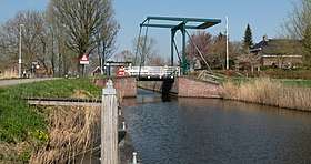
Drawing bridge near the Wolddijk-Stadsweg
Population centres
Garmerwolde, Lellens, Sint Annen, Ten Boer, Ten Post, Thesinge, Winneweer, Wittewierum and Woltersum.
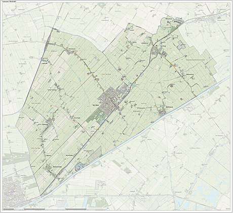
Dutch topographic map of the municipality of Ten Boer, June 2015
Notable people from Ten Boer
- Dirk van der Borg (born 1955), mayor of Graafstroom and Molenwaard
- Paul Drewes (born 1982), Olympic rower
- Hendrik Nienhuis (1790-1862), jurist and parliament member
- Remco van der Schaaf (born 1979), football player
gollark: It's wrong, then.
gollark: All IRC bots are, by bee law, to be made on APIONET.
gollark: T C P S O C K E T O R S O M E T H I N G
gollark: Try actually updating.
gollark: Sometimes.
References
- "Kerncijfers wijken en buurten" [Key figures for neighbourhoods]. CBS Statline (in Dutch). CBS. 2 July 2013. Retrieved 12 March 2014.
- "Postcodetool for 9791CT". Actueel Hoogtebestand Nederland (in Dutch). Het Waterschapshuis. Retrieved 4 February 2014.
External links

- Official website
Places adjacent to Ten Boer | ||||||||||
|---|---|---|---|---|---|---|---|---|---|---|
| ||||||||||
| Authority control |
|
|---|
This article is issued from Wikipedia. The text is licensed under Creative Commons - Attribution - Sharealike. Additional terms may apply for the media files.