Skirpenbeck
Skirpenbeck is a village and civil parish in the East Riding of Yorkshire, England. It is situated 2 miles (3.2 km) north-west of Stamford Bridge just north of the A166 road.
| Skirpenbeck | |
|---|---|
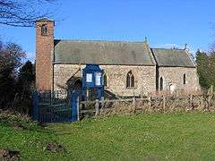 St Mary's Church at Skirpenbeck | |
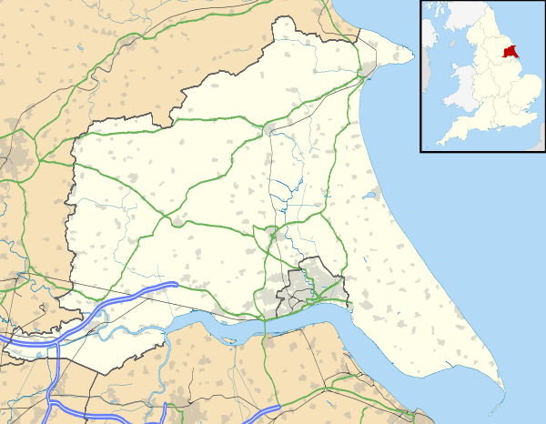 Skirpenbeck Location within the East Riding of Yorkshire | |
| Population | 192 (2011 census)[1] |
| OS grid reference | SE746570 |
| Civil parish |
|
| Unitary authority | |
| Ceremonial county | |
| Region | |
| Country | England |
| Sovereign state | United Kingdom |
| Post town | YORK |
| Postcode district | YO41 |
| Dialling code | 01759 |
| Police | Humberside |
| Fire | Humberside |
| Ambulance | Yorkshire |
| UK Parliament | |
According to the 2011 UK census, Skirpenbeck parish had a population of 192,[1] an increase on the 2001 UK census figure of 142.[2]
The place-name 'Skirpenbeck' is first attested in the Domesday Book of 1086, where it appears as Scarpenbec. It derives from the Old Norse skerping and bekkr, meaning barren land by a beck or stream.[3]
Skirpenbeck is near Stamford Bridge, over the River Derwent, near where King Harold of England defeated Harald Hardrada King of Norway in 1066. Its first baron was Sir William de Chauncy, son of Chauncy de Chauncy.
There are a number of working farms in the village. The number having reduced by four all of which have been subject to property development.
The parish church of St Mary's is a Grade II* listed building.[4]
There are markings on the church building (near the bell tower) that appear to be Saxon runes.
Alick Walker the palaeontologist was born in Skirpenbeck.[5]
Thomas Cooke the machinist was the school Headmaster in Skirpenbeck where he also created precision scientific instruments such as microscopes and telescopes.[6]
Governance
The parish has a joint parish council with Full Sutton, known as the Parish Council of Full Sutton and Skirpenbeck.[7]
References
- UK Census (2011). "Local Area Report – Skirpenbeck Parish (1170211261)". Nomis. Office for National Statistics. Retrieved 24 February 2018.
- UK Census (2001). "Local Area Report – Skirpenbeck Parish (00FB132)". Nomis. Office for National Statistics. Retrieved 29 February 2020.
- Eilert Ekwall, The Concise Oxford Dictionary of English Place-names, p.425.
- Historic England. "Church of St Mary (1161856)". National Heritage List for England. Retrieved 7 February 2013.
- Benton, Michael J; Walker, David J (2002). "Alick D. Walker 1925–1999: an appreciation" (PDF). Zoological Journal of the Linnean Society. 136: p. 1. doi:10.1046/j.1096-3642.1999.00022.x. Retrieved 4 June 2010.
- "Thomas Cooke". Pocklington History. Retrieved 8 October 2017.
- "Full Sutton and Skirpenbeck Villages". the Parish Council of Full Sutton and Skirpenbeck. Retrieved 14 October 2019.
- Gazetteer — A–Z of Towns Villages and Hamlets. East Riding of Yorkshire Council. 2006. p. 10.
External links
| Wikimedia Commons has media related to Skirpenbeck. |
- Historic England. "St Mary's Church (1161856)". National Heritage List for England.
- Skirpenbeck in the Domesday Book