Simonds Parish, Carleton County, New Brunswick
Simonds is a civil parish[lower-alpha 1] in Carleton County, New Brunswick, Canada. For governance purposes it is divided between the town of Florenceville-Bristol and the local service district of the parish of Simonds.
Simonds | |
|---|---|
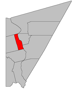 Location within Carleton County, New Brunswick | |
| Coordinates: 46.3275°N 67.5525°W | |
| Country | |
| Province | |
| County | Carleton |
| Established | 1842 |
| Area | |
| • Land | 75.56 km2 (29.17 sq mi) |
| Population (2016)[1] | |
| • Total | 473 |
| • Density | 6.3/km2 (16/sq mi) |
| • Pop 2011-2016 | |
| • Dwellings | 203 |
| Time zone | UTC-4 (AST) |
| • Summer (DST) | UTC-3 (ADT) |
Delineation
Simonds Parish is defined in the Territorial Division Act[2] as being bounded:
- North by the line between lots number ninety-three and ninety-four, near the mouth of Whitemarsh Brook and the westerly prolongation thereof; westerly by a line commencing on the northern boundary of Wakefield Parish, at a point where the eastern boundary of lot number thirty-two, granted to George Drake, in the third tier, strikes the same; thence running northerly along the eastern boundary of the said third tier to the eastern boundary of the grant to Arthur Blaney Walsh; thence northerly along the eastern boundary of the second tier of the Presquile block, until it strikes the northern boundary of the parish; south by Wakefield Parish; and east by the Saint John River, including all the islands in front.
Communities
Parish population total does not include incorporated municipalities (in bold):
|
|
Demographics
Population
|
LanguageMother tongue language (2016)
|
gollark: I could really use it, for purposes.
gollark: Can I use YOUR version for osmarks.tk then?
gollark: it used to have the dinosaur game but it was, what, 100KB?
gollark: Wait, could I use this as a game on the osmarks.tk offline page?
gollark: Impreßive.
See also
Notes
- Civil parishes served a variety of government functions until 1966, when the new Municipalities Act stripped them of their responsibilities; parishes continue to provide convenient boundaries for federal and provincial electoral districts. Statistics Canada uses civil parishes as census subdivisions for all parts of the province that are not within municipalities and similar entities.
References
- "Census Profile, 2016 Census: Simonds, Parish [Census subdivision], New Brunswick". Statistics Canada. Retrieved August 29, 2019.
- "Territorial Division Act (R.S.N.B. 1973, c. T-3)". Government of New Brunswick website. Retrieved 25 August 2016.
- Statistics Canada: 1996, 2001, 2006 census
- 2011 Statistics Canada Census Profile: Simonds Parish, New Brunswick
Places adjacent to Simonds Parish, Carleton County, New Brunswick | |
|---|---|
| Subdivisions |
|
|---|---|
| Cities | |
| Counties | |
| |
This article is issued from Wikipedia. The text is licensed under Creative Commons - Attribution - Sharealike. Additional terms may apply for the media files.