Silverton, British Columbia
Silverton is a village in the Slocan Valley area of the West Kootenay region of southeastern British Columbia, Canada. It is located on the eastern shore of Slocan Lake south of New Denver. It was once British Columbia's smallest municipality in both population and area.
Silverton | |
|---|---|
| The Corporation of the Village of Silverton[1] | |
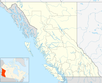 Location of Silverton in British Columbia | |
| Coordinates: 49°57′3″N 117°21′29″W | |
| Country | |
| Province | |
| Region | Slocan Valley |
| Regional district | Central Kootenay |
| Incorporated | 1930 |
| Government | |
| • Governing body | Silverton Village Council |
| Area | |
| • Total | 0.35 km2 (0.14 sq mi) |
| Elevation | 550 m (1,800 ft) |
| Population (2016) | |
| • Total | 195 |
| • Density | 550.5/km2 (1,426/sq mi) |
| Time zone | UTC-8 (PST) |
| Highways | 6 |
| Waterways | Slocan Lake |
| Website | Official website |
The village dates from the development of the silver mining in the 1890's, hence the name is probably a locally coined word. May be for Silverton Colorado.[2]
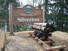
Silverton's welcome sign
References
- "British Columbia Regional Districts, Municipalities, Corporate Name, Date of Incorporation and Postal Address" (XLS). British Columbia Ministry of Communities, Sport and Cultural Development. Retrieved November 2, 2014.
- Hamilton, William (1978). The Macmillan Book of Canadian Place Names. Toronto: Macmillan. p. 50. ISBN 0-7715-9754-1.
| Subdivisions |  | |
|---|---|---|
| Communities | ||
| Metro areas and agglomerations |
| |
| Villages |
| |
| ||
This article is issued from Wikipedia. The text is licensed under Creative Commons - Attribution - Sharealike. Additional terms may apply for the media files.