Shire of Coolgardie
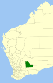
The Shire of Coolgardie is a local government area in the Goldfields-Esperance region of Western Australia, lying roughly west and south of the city of Kalgoorlie. The Shire covers an area of 30,400 square kilometres (11,738 sq mi), and its seat of government is the town of Coolgardie, although the twin towns of Kambalda and Kambalda West contain two-thirds of the Shire's population.
| Shire of Coolgardie Western Australia | |||||||||||||||
|---|---|---|---|---|---|---|---|---|---|---|---|---|---|---|---|
 Location in Western Australia | |||||||||||||||
| Population | 3,610 (2016 census)[1] | ||||||||||||||
| • Density | 0.1188/km2 (0.3076/sq mi) | ||||||||||||||
| Established | 1921 | ||||||||||||||
| Area | 30,400 km2 (11,737.5 sq mi) | ||||||||||||||
| Mayor | Malcolm Cullen | ||||||||||||||
| Council seat | Coolgardie | ||||||||||||||
| Region | Goldfields-Esperance | ||||||||||||||
| State electorate(s) | Kalgoorlie | ||||||||||||||
| Federal Division(s) | O'Connor | ||||||||||||||
| Website | Shire of Coolgardie | ||||||||||||||
| |||||||||||||||
History
The Shire of Coolgardie originated as the Coolgardie Road District, which was established on 7 August 1896, consisting of the rural areas surrounding the town of Coolgardie, which had already been incorporated as the Municipality of Coolgardie in 1894. As the gold rush waned in the area, the municipality merged into the road district on 20 May 1921.[2]
It was declared a shire with effect from 1 July 1961 following the passage of the Local Government Act 1960, which reformed all remaining road districts into shires.[2]
Wards
In 2007, the ward system was abolished. Prior to this, the Shire had eight councillors and four wards:
- Kambalda West (three councillors)
- Kambalda (two councillors)
- Coolgardie (two councillors)
- Country (one councillor)
Towns
Photos
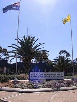 Shire of Coolgardie office.
References
- Australian Bureau of Statistics (27 June 2017). "Coolgardie (S)". 2016 Census QuickStats. Retrieved 26 November 2017.

- "Municipality Boundary Amendments Register" (PDF). Western Australian Electoral Distribution Commission. Retrieved 11 January 2020.