Sherrelwood, Colorado
Sherrelwood is a census-designated place in Adams County, Colorado, United States. The population was 18,287 at the 2010 census.[2]
Sherrelwood, Colorado | |
|---|---|
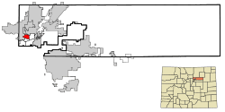 Location in Adams County and the state of Colorado | |
| Coordinates: 39°50′27″N 105°0′6″W | |
| Country | |
| State | |
| County | Adams[1] |
| Government | |
| • Type | unincorporated community |
| Area | |
| • Total | 2.45 sq mi (6.35 km2) |
| • Land | 2.43 sq mi (6.29 km2) |
| • Water | 0.02 sq mi (0.06 km2) |
| Elevation | 5,292 ft (1,613 m) |
| Population (2010) | |
| • Total | 18,287 |
| • Density | 7,530/sq mi (2,907.4/km2) |
| Time zone | UTC-7 (Mountain (MST)) |
| • Summer (DST) | UTC-6 (MDT) |
| ZIP code | 80221 |
| FIPS code | 08-69810 |
| GNIS feature ID | 1867088 |
Geography
Sherrelwood is located at 39°50′27″N 105°0′6″W (39.840722, -105.001540).[3]
According to the United States Census Bureau, the CDP has a total area of 2.45 square miles (6.35 km2), of which 2.43 square miles (6.29 km2) is land and 0.023 square miles (0.06 km2), or 0.88%, is water.[2]
Demographics
| Historical population | |||
|---|---|---|---|
| Census | Pop. | %± | |
| U.S. Decennial Census[4] | |||
As of the census[5] of 2000, there were 17,657 people, 6,082 households, and 4,452 families residing in the CDP. The population density was 7,222.5 people per square mile (2,794.0/km2). There were 6,163 housing units at an average density of 2,520.9 per square mile (975.2/km2). The racial makeup of the CDP was 72.01% White, 1.21% African American, 1.18% Native American, 3.38% Asian, 0.19% Pacific Islander, 18.03% from other races, and 4.00% from two or more races. Hispanic or Latino of any race were 39.83% of the population.
There were 6,082 households out of which 35.3% had children under the age of 18 living with them, 52.8% were married couples living together, 13.9% had a female householder with no husband present, and 26.8% were non-families. 18.7% of all households were made up of individuals and 4.8% had someone living alone who was 65 years of age or older. The average household size was 2.90 and the average family size was 3.31.
In the CDP, the population was spread out with 27.4% under the age of 18, 12.5% from 18 to 24, 31.2% from 25 to 44, 19.3% from 45 to 64, and 9.6% who were 65 years of age or older. The median age was 31 years. For every 100 females, there were 102.7 males. For every 100 females age 18 and over, there were 102.6 males.
The median income for a household in the CDP was $42,722, and the median income for a family was $45,734. Males had a median income of $31,833 versus $26,853 for females. The per capita income for the CDP was $17,036. About 5.9% of families and 8.3% of the population were below the poverty line, including 7.9% of those under age 18 and 5.8% of those age 65 or over.
See also
- Outline of Colorado
- State of Colorado
- Colorado cities and towns
- Colorado census designated places
- Colorado counties
- Colorado metropolitan areas
- Front Range Urban Corridor
- North Central Colorado Urban Area
- Denver-Aurora-Boulder, CO Combined Statistical Area
- Denver-Aurora-Broomfield, CO Metropolitan Statistical Area
- Colorado cities and towns
References
- "US Board on Geographic Names". United States Geological Survey. 2007-10-25. Retrieved 2008-01-31.
- "Geographic Identifiers: 2010 Demographic Profile Data (G001): Sherrelwood CDP, Colorado". U.S. Census Bureau, American Factfinder. Archived from the original on February 12, 2020. Retrieved May 1, 2013.
- "US Gazetteer files: 2010, 2000, and 1990". United States Census Bureau. 2011-02-12. Retrieved 2011-04-23.
- "Census of Population and Housing". Census.gov. Retrieved June 4, 2016.
- "U.S. Census website". United States Census Bureau. Retrieved 2008-01-31.
Municipalities and communities of Adams County, Colorado, United States | ||
|---|---|---|
| Cities | 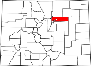 Map of Colorado highlighting Adams County | |
| Towns | ||
| CDPs | ||
| Unincorporated communities | ||
| Footnotes | ‡This populated place also has portions in an adjacent county or counties | |