Shelikan
Shelikan, also Ostrovok Shelikan, is a coastal islet in the Sea of Okhotsk near Magadan. It lies on the south side of Amakhton Bay.[2]
Shelikan | |
|---|---|
 Shelikan | |
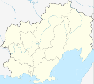
| Coordinates: 59°35′N 149°08′E | |
| Country | Russian Federation |
| Federal subject | Far Eastern Federal District |
| Oblast | Magadan Oblast |
| Elevation | 122 m (400 ft) |
Geography
Shelikan is located on the west side of Taui Bay and is separated from the continental shore by a 2.5 km wide sound. It is 122 m (400 ft) in height and is surrounded by shallow water.[3]
Administratively this island is part of the Magadan Oblast.[4]
Fauna
In the spring and summer one of the largest known colonies of slaty-backed gull in the Russian Far East is found on the island.[5]
gollark: Due to computing constraints, it operates *entirely* on the introductory segments of Wikipedia pages.
gollark: "Firecubez" is incomprehensible to it.
gollark: Unless I can *somehow* make this use a different NN backend without beeing utterly.
gollark: On an unrelated note, I am cancelling all efforts to develop a less slow ++experimental_qa because it is too irritating.
gollark: Ah, applied principle of explosion.
References
- GoogleEarth
- National Geospatial-Intelligence Agency. (2014). Sailing Directions (Enroute): East Coast of Russia. U.S. Government, Springfield, Virginia.
- United States. Naval Oceanographic Office (1952). Sailing directions for the east coast of Siberia, Mys Otto Shmidta to Sakhalinskiy Zaliv including Ostrov Vrangelya. p. 246. Retrieved 17 October 2012.
- Ostrovok Shelikan (Ostrov Shelikan) / Magadanskaya Oblast'
- Kondratyev, A. Y., Litvinenko, N. M., Shibaev, Y. V., Vyatkin, P. S., & Kondratyeva, L. F. (2000). "The breeding seabirds of the Russian Far East". Seabirds of the Russian Far East, 37-81.
This article is issued from Wikipedia. The text is licensed under Creative Commons - Attribution - Sharealike. Additional terms may apply for the media files.