Sheep Hills, Victoria
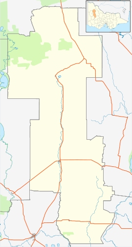
Sheep Hills is a locality in the northern Wimmera region, north-west Victoria. It is 271 km north-west of Melbourne.[3] The town is situated on the railway line south-east of Warracknabeal, north of Minyip.[4]
| Sheep Hills Victoria | |||||||||
|---|---|---|---|---|---|---|---|---|---|
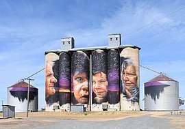 Silo art at Sheep Hills, 2018 | |||||||||
 Sheep Hills | |||||||||
| Coordinates | 36.3495°S 142.5297°E | ||||||||
| Population | 28 (2016 census)[1] | ||||||||
| Established | 1847 | ||||||||
| Postcode(s) | 3392 | ||||||||
| Elevation | 147[2] m (482 ft) | ||||||||
| Location | |||||||||
| LGA(s) | Shire of Yarriambiack | ||||||||
| State electorate(s) | Lowan | ||||||||
| Federal Division(s) | Mallee | ||||||||
| |||||||||
The original inhabitants of the area around Sheep Hills were the Wotjobaluk, an Aboriginal Australian people.[5]
Sheep Hills was the name of a farm operated by Archibald McMillan in 1847.[4] The population boosted in the mid-1870s when many migrants, mostly German and Scottish, began farming in the area.[4] The district was named Bangerang (the name of a Lutheran school) and Tarkedia (the name of a State school).[4] In 1886 the railway from Minyip was extended to Warracknabeal, and many settled around the station, forming the township under the name of Sheep Hills.[4]
As of 2016, Sheep Hills has a cricket, a golf and a tennis club.[6] Also in use is the Sheep Hills Town Hall.[6]
References
- Australian Bureau of Statistics (27 June 2017). "Sheep Hills (State Suburb)". 2016 Census QuickStats. Retrieved 19 March 2018.

- http://weather.mla.com.au/climate-history/vic/sheep-hills
- http://postcodez.com.au/postcode/vic/sheep-hills
- http://www.victorianplaces.com.au/sheep-hills
- Reader's Digest Illustrated Guide to Australian Places, 1993.
- http://yarriambiack.vic.gov.au/about-yarriambiack-council/community-directory/sheep-hills/
External links
![]()