Santa Claus, Georgia
Santa Claus is a city in Toombs County, Georgia, United States. The population was 165 at the 2010 census. It is part of the Vidalia Micropolitan Statistical Area.
Santa Claus, Georgia | |
|---|---|
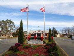 Santa Claus City Hall | |
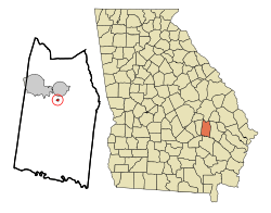 Location in Toombs County and the state of Georgia | |
| Coordinates: 32°10′15″N 82°19′52″W | |
| Country | United States |
| State | Georgia |
| County | Toombs |
| Area | |
| • Total | 0.18 sq mi (0.48 km2) |
| • Land | 0.18 sq mi (0.48 km2) |
| • Water | 0.00 sq mi (0.00 km2) |
| Elevation | 235 ft (72 m) |
| Population (2010) | |
| • Total | 165 |
| • Estimate (2019)[2] | 159 |
| • Density | 864.13/sq mi (332.99/km2) |
| Time zone | UTC-5 (Eastern (EST)) |
| • Summer (DST) | UTC-4 (EDT) |
| ZIP code | 30436 |
| Area code(s) | 912 Exchange: 526 |
| FIPS code | 13-68600[3] |
| GNIS feature ID | 0322506[4] |
The city has several Christmas-themed street names: Candy Cane Road, December Drive, Rudolph Way, Dancer Street, Prancer Street, and Sleigh Street.[5]
History
A local entrepreneur named the community after Santa Claus, the Christmas character, with the aim of attracting tourists to his pecan business and adjacent motel.[6] Santa Claus was incorporated as a city in 1941.[5]
Geography
Santa Claus is located at 32°10′15″N 82°19′52″W (32.170863, -82.331129).[7]
According to the United States Census Bureau, the city has a total area of 0.2 square mile (0.5 km2), all land.
Demographics
| Historical population | |||
|---|---|---|---|
| Census | Pop. | %± | |
| 1960 | 5 | — | |
| 1970 | 118 | 2,260.0% | |
| 1980 | 167 | 41.5% | |
| 1990 | 154 | −7.8% | |
| 2000 | 237 | 53.9% | |
| 2010 | 165 | −30.4% | |
| Est. 2019 | 159 | [2] | −3.6% |
| U.S. Decennial Census[8] | |||
As of the census[3] of 2000, there were 250 people, 92 households, and 66 families residing in the city. The population density was 1,297.2 people per square mile (600/km2). There were 102 housing units at an average density of 487.1 per square mile (190.9/km2). The racial makeup of the city was 82.28% White, 1.69% African American, 16.03% from other races. Hispanic or Latino of any race were 24.89% of the population.
There were 79 households out of which 31.6% had children under the age of 18 living with them, 48.1% were married couples living together, 12.7% had a female householder with no husband present, and 32.9% were non-families. 21.5% of all households were made up of individuals and 1.3% had someone living alone who was 65 years of age or older. The average household size was 3.00 and the average family size was 3.06.
In the city, the population was spread out with 22.4% under the age of 18, 17.7% from 18 to 24, 28.7% from 25 to 44, 24.9% from 45 to 64, and 6.3% who were 65 years of age or older. The median age was 30 years. For every 100 females, there were 119.4 males. For every 100 females age 18 and over, there were 109.1 males.
The median income for a household in the city was $28,750, and the median income for a family was $32,857. Males had a median income of $27,250 versus $15,750 for females. The per capita income for the city was $13,669. About 13.2% of families and 20.3% of the population were below the poverty line, including 22.5% of those under the age of eighteen and 58.3% of those 65 or over.
See also
References
- "2019 U.S. Gazetteer Files". United States Census Bureau. Retrieved July 9, 2020.
- "Population and Housing Unit Estimates". United States Census Bureau. May 24, 2020. Retrieved May 27, 2020.
- "U.S. Census website". United States Census Bureau. Retrieved 2008-01-31.
- "US Board on Geographic Names". United States Geological Survey. 2007-10-25. Retrieved 2008-01-31.
- "Santa Claus". State of Georgia. Retrieved 24 March 2014.
- Krakow, Kenneth K. (1975). Georgia Place-Names: Their History and Origins (PDF). Macon, GA: Winship Press. p. 198. ISBN 0-915430-00-2.
- "US Gazetteer files: 2010, 2000, and 1990". United States Census Bureau. 2011-02-12. Retrieved 2011-04-23.
- "Census of Population and Housing". Census.gov. Retrieved June 4, 2015.
Municipalities and communities of Toombs County, Georgia, United States | ||
|---|---|---|
| Cities | 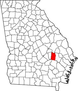 Map of Georgia highlighting Toombs County | |
| Unincorporated community | ||
| Footnotes | ‡This populated place also has portions in an adjacent county or counties | |