Santa Anna Township, DeWitt County, Illinois
Santa Anna Township is one of thirteen townships in DeWitt County, Illinois, USA. As of the 2010 census, its population was 2,502 and it contained 1,116 housing units.[1] Its name was changed from Mt. Pleasant Township on June 7, 1859.
Santa Anna Township | |
|---|---|
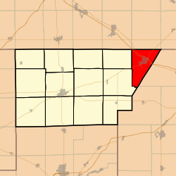 Location in DeWitt County | |
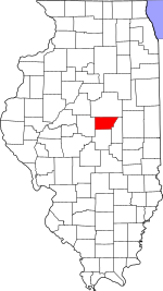 DeWitt County's location in Illinois | |
| Coordinates: 40°14′23″N 88°38′55″W | |
| Country | |
| State | |
| County | DeWitt |
| Established | November 2, 1858 |
| Area | |
| • Total | 29.09 sq mi (75.3 km2) |
| • Land | 28.96 sq mi (75.0 km2) |
| • Water | 0.13 sq mi (0.3 km2) 0.45% |
| Elevation | 728 ft (222 m) |
| Population (2010) | |
| • Total | 2,502 |
| • Density | 86.4/sq mi (33.4/km2) |
| Time zone | UTC-6 (CST) |
| • Summer (DST) | UTC-5 (CDT) |
| ZIP code | 61842 |
| GNIS feature ID | 0429713 |
Geography
According to the 2010 census, the township has a total area of 29.09 square miles (75.3 km2), of which 28.96 square miles (75.0 km2) (or 99.55%) is land and 0.13 square miles (0.34 km2) (or 0.45%) is water.[1]
Cities, towns, villages
Unincorporated towns
(This list is based on USGS data and may include former settlements.)
Cemeteries
The township contains these five cemeteries: Campground, Farmer City, Greenleaf, Maple Grove and Saint Josephs Catholic.
School districts
- Blue Ridge Community Unit School District 18
- Deland-Weldon Community Unit School District 57
Political districts
- Illinois's 15th congressional district
- State House District 87
- State Senate District 44
gollark: Heavserver is NOT banned yet.
gollark: macronaltmacrohackcheatmacronon
gollark: <:borrow_check:812780469442969620>
gollark: ++data set_global apio <:apioform:812013353165389875> <:apiokinetoform:812113642991517757> <:apiopariform:812119400881848321> <:apiopyroform:812110715393146890> <:cryoapioform:812015306662477864>
gollark: Replication.
References
- "Santa Anna Township, DeWitt County, Illinois". Geographic Names Information System. United States Geological Survey. Retrieved 2010-07-06.
- United States Census Bureau 2009 TIGER/Line Shapefiles
- United States National Atlas
- "Population, Housing Units, Area, and Density: 2010 - County -- County Subdivision and Place -- 2010 Census Summary File 1". United States Census. Archived from the original on 2020-02-12. Retrieved 2013-05-28.
External links
Places adjacent to Santa Anna Township, DeWitt County, Illinois | |
|---|---|
Municipalities and communities of DeWitt County, Illinois, United States | ||
|---|---|---|
| Cities | Map of Illinois highlighting DeWitt County | |
| Villages | ||
| Townships | ||
| Unincorporated communities | ||
| Footnotes | ‡This populated place also has portions in an adjacent county or counties | |
This article is issued from Wikipedia. The text is licensed under Creative Commons - Attribution - Sharealike. Additional terms may apply for the media files.