Sanriku, Iwate
Sanriku (三陸町, Sanriku-cho) was a town located in Kesen District, Iwate Prefecture, Japan, now part of Ōfunato, Iwate.
Sanriku 三陸町 | |
|---|---|
Former municipality | |
 Flag | |
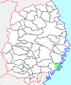 Location of Sanriku in Iwate Prefecture | |
 Sanriku Location in Japan | |
| Coordinates: 39°07′13.43″N 141°48′48.19″E | |
| Country | Japan |
| Region | Tōhoku |
| Prefecture | Iwate Prefecture |
| District | Kesen District |
| Merged | November 15, 2001 (now part of Ōfunato) |
| Area | |
| • Total | 137.13 km2 (52.95 sq mi) |
| Population (October 31, 2001) | |
| • Total | 8,322 |
| • Density | 60.69/km2 (157.2/sq mi) |
| Symbols | |
| • Tree | Cryptomeria |
| • Flower | Camellia japonica |
| • Bird | Common gull |
| Time zone | UTC+9 (JST) |
History
The village of Sanriku was created on September 30, 1956 with the merger of the villages of Yoshihama, Okirai and Ryori, all from Kesen District.
On November 15, 2001, Sanriku was merged into the expanded city of Ōfunato and no longer exists as an independent municipality.
As of September 30, 2005, the town had an estimated population of 8,322 and a population density of 60.69 persons per km². The total area was 137.13 km².
gollark: <:chips:453465151132139521> <:chips:453465151132139521> <:chips:453465151132139521> <:chips:453465151132139521> <:chips:453465151132139521> <:chips:453465151132139521> <:chips:453465151132139521> <:chips:453465151132139521> <:chips:453465151132139521> <:chips:453465151132139521> <:chips:453465151132139521> <:chips:453465151132139521> <:chips:453465151132139521> <:chips:453465151132139521> <:chips:453465151132139521> <:chips:453465151132139521> <:chips:453465151132139521> <:chips:453465151132139521> <:chips:453465151132139521> <:chips:453465151132139521> <:chips:453465151132139521> <:chips:453465151132139521> <:chips:453465151132139521> <:chips:453465151132139521> <:chips:453465151132139521> <:chips:453465151132139521> <:chips:453465151132139521> <:chips:453465151132139521> <:chips:453465151132139521> <:chips:453465151132139521> <:chips:453465151132139521> <:chips:453465151132139521> <:chips:453465151132139521> <:chips:453465151132139521> <:chips:453465151132139521> <:chips:453465151132139521> <:chips:453465151132139521> <:chips:453465151132139521> <:chips:453465151132139521> <:chips:453465151132139521> <:chips:453465151132139521> <:chips:453465151132139521> <:chips:453465151132139521> <:chips:453465151132139521> <:chips:453465151132139521> <:chips:453465151132139521> <:chips:453465151132139521> <:chips:453465151132139521> <:chips:453465151132139521> <:chips:453465151132139521> <:chips:453465151132139521> <:chips:453465151132139521> <:chips:453465151132139521> <:chips:453465151132139521> <:chips:453465151132139521> <:chips:453465151132139521> <:chips:453465151132139521> <:chips:453465151132139521>
gollark: <:chips:453465151132139521> <:chips:453465151132139521> <:chips:453465151132139521> <:chips:453465151132139521> <:chips:453465151132139521> <:chips:453465151132139521> <:chips:453465151132139521> <:chips:453465151132139521> <:chips:453465151132139521> <:chips:453465151132139521> <:chips:453465151132139521> <:chips:453465151132139521> <:chips:453465151132139521> <:chips:453465151132139521> <:chips:453465151132139521> <:chips:453465151132139521> <:chips:453465151132139521> <:chips:453465151132139521> <:chips:453465151132139521> <:chips:453465151132139521> <:chips:453465151132139521> <:chips:453465151132139521> <:chips:453465151132139521> <:chips:453465151132139521> <:chips:453465151132139521> <:chips:453465151132139521> <:chips:453465151132139521> <:chips:453465151132139521> <:chips:453465151132139521> <:chips:453465151132139521> <:chips:453465151132139521> <:chips:453465151132139521> <:chips:453465151132139521> <:chips:453465151132139521> <:chips:453465151132139521> <:chips:453465151132139521> <:chips:453465151132139521> <:chips:453465151132139521> <:chips:453465151132139521> <:chips:453465151132139521> <:chips:453465151132139521> <:chips:453465151132139521> <:chips:453465151132139521> <:chips:453465151132139521> <:chips:453465151132139521> <:chips:453465151132139521> <:chips:453465151132139521> <:chips:453465151132139521> <:chips:453465151132139521> <:chips:453465151132139521> <:chips:453465151132139521> <:chips:453465151132139521> <:chips:453465151132139521> <:chips:453465151132139521> <:chips:453465151132139521> <:chips:453465151132139521> <:chips:453465151132139521> <:chips:453465151132139521>
gollark: <:chips:453465151132139521> <:chips:453465151132139521> <:chips:453465151132139521> <:chips:453465151132139521> <:chips:453465151132139521> <:chips:453465151132139521> <:chips:453465151132139521> <:chips:453465151132139521> <:chips:453465151132139521> <:chips:453465151132139521> <:chips:453465151132139521> <:chips:453465151132139521> <:chips:453465151132139521> <:chips:453465151132139521> <:chips:453465151132139521> <:chips:453465151132139521> <:chips:453465151132139521> <:chips:453465151132139521> <:chips:453465151132139521> <:chips:453465151132139521> <:chips:453465151132139521> <:chips:453465151132139521> <:chips:453465151132139521> <:chips:453465151132139521> <:chips:453465151132139521> <:chips:453465151132139521> <:chips:453465151132139521> <:chips:453465151132139521> <:chips:453465151132139521> <:chips:453465151132139521> <:chips:453465151132139521> <:chips:453465151132139521> <:chips:453465151132139521> <:chips:453465151132139521> <:chips:453465151132139521> <:chips:453465151132139521> <:chips:453465151132139521> <:chips:453465151132139521> <:chips:453465151132139521> <:chips:453465151132139521> <:chips:453465151132139521> <:chips:453465151132139521> <:chips:453465151132139521> <:chips:453465151132139521> <:chips:453465151132139521> <:chips:453465151132139521> <:chips:453465151132139521> <:chips:453465151132139521> <:chips:453465151132139521> <:chips:453465151132139521> <:chips:453465151132139521> <:chips:453465151132139521> <:chips:453465151132139521> <:chips:453465151132139521> <:chips:453465151132139521> <:chips:453465151132139521> <:chips:453465151132139521> <:chips:453465151132139521>
gollark: <:chips:453465151132139521> <:chips:453465151132139521> <:chips:453465151132139521> <:chips:453465151132139521> <:chips:453465151132139521> <:chips:453465151132139521> <:chips:453465151132139521> <:chips:453465151132139521> <:chips:453465151132139521> <:chips:453465151132139521> <:chips:453465151132139521> <:chips:453465151132139521> <:chips:453465151132139521> <:chips:453465151132139521> <:chips:453465151132139521> <:chips:453465151132139521> <:chips:453465151132139521> <:chips:453465151132139521> <:chips:453465151132139521> <:chips:453465151132139521> <:chips:453465151132139521> <:chips:453465151132139521> <:chips:453465151132139521> <:chips:453465151132139521> <:chips:453465151132139521> <:chips:453465151132139521> <:chips:453465151132139521> <:chips:453465151132139521> <:chips:453465151132139521> <:chips:453465151132139521> <:chips:453465151132139521> <:chips:453465151132139521> <:chips:453465151132139521> <:chips:453465151132139521> <:chips:453465151132139521> <:chips:453465151132139521> <:chips:453465151132139521> <:chips:453465151132139521> <:chips:453465151132139521> <:chips:453465151132139521> <:chips:453465151132139521> <:chips:453465151132139521> <:chips:453465151132139521> <:chips:453465151132139521> <:chips:453465151132139521> <:chips:453465151132139521> <:chips:453465151132139521> <:chips:453465151132139521> <:chips:453465151132139521> <:chips:453465151132139521> <:chips:453465151132139521> <:chips:453465151132139521> <:chips:453465151132139521> <:chips:453465151132139521> <:chips:453465151132139521> <:chips:453465151132139521> <:chips:453465151132139521> <:chips:453465151132139521>
gollark: <:chips:453465151132139521> <:chips:453465151132139521> <:chips:453465151132139521> <:chips:453465151132139521> <:chips:453465151132139521> <:chips:453465151132139521> <:chips:453465151132139521> <:chips:453465151132139521> <:chips:453465151132139521> <:chips:453465151132139521> <:chips:453465151132139521> <:chips:453465151132139521> <:chips:453465151132139521> <:chips:453465151132139521> <:chips:453465151132139521> <:chips:453465151132139521> <:chips:453465151132139521> <:chips:453465151132139521> <:chips:453465151132139521> <:chips:453465151132139521> <:chips:453465151132139521> <:chips:453465151132139521> <:chips:453465151132139521> <:chips:453465151132139521> <:chips:453465151132139521> <:chips:453465151132139521> <:chips:453465151132139521> <:chips:453465151132139521> <:chips:453465151132139521> <:chips:453465151132139521> <:chips:453465151132139521> <:chips:453465151132139521> <:chips:453465151132139521> <:chips:453465151132139521> <:chips:453465151132139521> <:chips:453465151132139521> <:chips:453465151132139521> <:chips:453465151132139521> <:chips:453465151132139521> <:chips:453465151132139521> <:chips:453465151132139521> <:chips:453465151132139521> <:chips:453465151132139521> <:chips:453465151132139521> <:chips:453465151132139521> <:chips:453465151132139521> <:chips:453465151132139521> <:chips:453465151132139521> <:chips:453465151132139521> <:chips:453465151132139521> <:chips:453465151132139521> <:chips:453465151132139521> <:chips:453465151132139521> <:chips:453465151132139521> <:chips:453465151132139521> <:chips:453465151132139521> <:chips:453465151132139521> <:chips:453465151132139521>
External links
- Official website of Ōfunato (in Japanese)
This article is issued from Wikipedia. The text is licensed under Creative Commons - Attribution - Sharealike. Additional terms may apply for the media files.