Sandhutton
Sandhutton is a small village and civil parish in Hambleton district of North Yorkshire, England. It lies about 3 miles (5 km) west of Thirsk on the A167.[2] It has been referred to as Hutton, Hutton (Sand),[3] and Sand Hutton. The name derives from Old English sand-hōh-tūn which translates as a shaply projecting piece of sandy ground with an enclosure, farmstead or village upon it.[4]
| Sandhutton | |
|---|---|
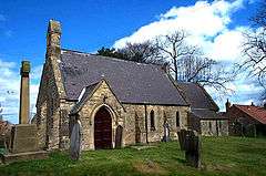 St Leonard's Church with Sandhutton's War Memorial on the left | |
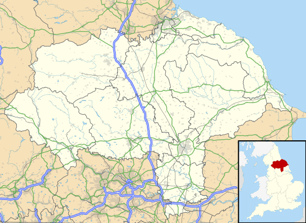 Sandhutton Location within North Yorkshire | |
| Population | 261 (2011 census)[1] |
| OS grid reference | SE382820 |
| Civil parish |
|
| District | |
| Shire county | |
| Region | |
| Country | England |
| Sovereign state | United Kingdom |
| Post town | THIRSK |
| Postcode district | YO7 |
| Police | North Yorkshire |
| Fire | North Yorkshire |
| Ambulance | Yorkshire |
East of the village, on the road to Carlton Miniott, is the Sand Hutton Cross which is now a listed monument. the cross marked the point at which three parishes met and is designated due to the fact that it has survived despite intensive arable farming in the area.[5]
In 2017, a 45 acres (18 ha) solar farm was installed to the east of the village. The scheme involved the placing of 20,000 photovoltaic panels that would generate up to 5 MWh and would have a life expectancy of 25 years.[6][7]
Transport
The village lies on the A167 road[8] which has a junction with the A61 road just south of the village at Busby Stoop. The Leeds and Thirsk Railway had a station called Topcliffe which was situated just south of the crossroads at Busby Stoop, however, this closed in 1959[9] and the nearest railway station is Thirsk which is just over 2 miles (3 km) away.[2]
References
- UK Census (2011). "Local Area Report – Sandhutton Parish (1170216914)". Nomis. Office for National Statistics. Retrieved 21 May 2018.
- "302" (Map). Northallerton & Thirsk. 1;25,000. Explorer. Ordnance Survey. 2015. ISBN 9780319245545.
- "History of Sand Hutton, in Hambleton and North Riding | Map and description". www.visionofbritain.org.uk. Retrieved 1 November 2017.
- Ekwall, Eilert (1960). The concise Oxford dictionary of English place-names (4 ed.). Oxford: Clarendon Press. p. 259. ISBN 0-19-869103-3.
- Historic England. "Sand Hutton Cross (1011748)". National Heritage List for England. Retrieved 1 November 2017.
- Minting, Stuart (8 June 2015). "Renewable energy firms unveil plans for large solar farms". Darlington and Stockton Times. Retrieved 1 November 2017.
- "Sandhutton Solar Farm Renewable energy scheme / Solar". www.renewables-map.co.uk. Retrieved 1 November 2017.
- "Sandhutton Parish Council | Home". www.parish-council.com. Retrieved 1 November 2017.
- "Disused Stations:Topcliffe Station". www.disused-stations.org.uk. Retrieved 1 November 2017.
External links
![]()