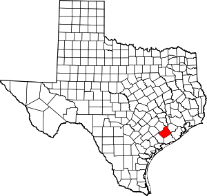
Sand Ridge, Wharton County, Texas
Sand Ridge is an Unincorporated community in north central Wharton County, in the U.S. state of Texas. The tiny community is located northwest of Wharton at the intersection of FM 102 and County Road 259. Situated on the former Cane Belt Railroad, the settlement had its own school in 1905. There were no road signs identifying the place in 2013, but a church and a cemetery with the community name occupied the site. Some homes and several oil wells were located nearby.
Sand Ridge, Texas | |
|---|---|
Unincorporated community | |
 Sand Ridge, Texas Location within the state of Texas | |
| Coordinates: 29°25′06″N 96°15′08″W | |
| Country | United States |
| State | Texas |
| County | Wharton |
| Elevation | 138 ft (42 m) |
| Time zone | UTC-6 (Central (CST)) |
| • Summer (DST) | UTC-5 (CDT) |
| ZIP code | 77488 |
| Area code(s) | 979 |
| GNIS | 1379021[1] |
Geography
Sand Ridge is situated at 29°25′06″N 96°15′08″W.[1] This location is at the junction of FM 102 and County Road 259 a distance of 12.1 miles (19.5 km) northwest of Wharton and 13.6 miles (21.9 km) southeast of Eagle Lake. Locally, Sand Ridge is 1.1 miles (1.8 km) northwest of the Egypt community. A string of oil wells stretches from the southwest to the northeast through the Sand Ridge area.[2] The wells are part of the Egypt Oil Field which is centered near 29°25′51″N 96°13′14″W,[3] or about 2 miles (3.2 km) east of Sand Ridge.[2]
History
In 1905 there were 50 black students enrolled in the Sand Ridge school, which also had one teacher.[4] The first producing oil well in Wharton County was drilled in 1925 in the Boling Field near Iago. This started an oil drilling boom during which numerous fields were exploited.[5] Maps of 1936 displayed two churches, a cemetery and several homes in Sand Ridge. In the 1980s the New Colorado Tabernacle Church and another church and several homes were in the vicinity. The railroad was discontinued in 1992 and the rails removed.[4] In 2013 the Sandridge Baptist Church[6] and the adjacent San Ridge & Mt Gilead Cemetery were located at the site.[note 1]
- Sandridge Baptist Church at FM 102 and County Road 259
- Sand Ridge and Mt Gilead Cemetery on FM 102
- Oil well on County Road 259 north of Sand Ridge
References
- Footnotes
- See photos.
- Citations
- U.S. Geological Survey Geographic Names Information System: Sand Ridge, Texas. Retrieved on August 11, 2013.
- Google (August 12, 2013). "Sand Ridge, Wharton County, Texas" (Map). Google Maps. Google. Retrieved August 12, 2013.
- U.S. Geological Survey Geographic Names Information System: Egypt Oil Field, Texas
- Kleiner, Diana J. "Handbook of Texas Online: SAND RIDGE, TX (WHARTON COUNTY)". Texas State Historical Association. Retrieved August 11, 2013.
- Hudgins, Merle R. "Handbook of Texas Online: WHARTON COUNTY". Texas State Historical Association. Retrieved August 11, 2013.
- "Sandridge Baptist Church". YP Yellow Pages. Retrieved August 16, 2013.
