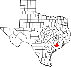
Egypt, Wharton County, Texas
Egypt is an unincorporated community in northern Wharton County in the U.S. state of Texas.
Egypt, Texas | |
|---|---|
Unincorporated community | |
Post office | |
 Egypt, Texas Location within the state of Texas | |
| Coordinates: 29°24′18″N 96°14′13″W | |
| Country | United States |
| State | Texas |
| County | Wharton |
| Elevation | 131 ft (40 m) |
| Time zone | UTC-6 (Central (CST)) |
| • Summer (DST) | UTC-5 (CDT) |
| ZIP code | 77436 |
| Area code(s) | 979 |
| GNIS | 1335133[1] |
History
Egypt was founded before any other settlement in Wharton County and was a part of Colorado County during the Republic of Texas period.[2]
Egypt's 1827 name change from "Mercer's Crossing" came from the Bible, and originated from the text of Genesis 42:1-3.[2][3][4]
- Heard-Northington Plantation
gollark: You called it didn't you?
gollark: Isn't there some discord.py fork with it?
gollark: (This rhymes, yes)
gollark: It's +441234815763, and you can dial it for arbitrary bee.
gollark: How would TTS work? The apioform hotline is an actual phone thing.
References
- U.S. Geological Survey Geographic Names Information System: Egypt, Texas. Retrieved on August 15, 2013.
- Young, Barbara L. "Handbook of Texas Online: EGYPT, TX (WHARTON COUNTY)". Texas State Historical Association. Retrieved November 21, 2017.
- Boat Design Net, Random Picture Thread. "The Egypt in Wharton County Texas US, 1827 name nascency from the Bible in Genesis 42:1-3". References are the shown & sourced by Wikipedia free to use Texas Egypt historical marker picture, and the Biblical links in the bottom line of the linked Boat Design Net Random Picture Thread post. Publisher: www.boatdesign.net. Retrieved December 22, 2017.
- Boat Design Net, Random Picture Thread. "Exact location of the two State of Texas history plaques regarding the Capt. W.J.E. Heard plantation and the unincorporated community of Egypt in Wharton County TX, on the Farm to Market Rd 1161 W (aka: W FM 1161 Rd) in Egypt, Wharton, TX, USA. @ 29°24'13.6"N 96°14'00.6"W". References are the Google aerial view map & street view links in the linked Boat Design Net Random Picture Thread post. Publisher: www.boatdesign.net. Retrieved December 22, 2017.
This article is issued from Wikipedia. The text is licensed under Creative Commons - Attribution - Sharealike. Additional terms may apply for the media files.
