San Tomé Airport
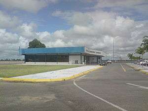
San Tomé Airport (IATA: SOM, ICAO: SVST) is an airport at the town of San Tomé, in the Venezuelan state of Anzoátegui. Also known as Don Edmundo Barrios Airport (Spanish: Aeropuerto Don Edmundo Barrios), it also serves the cities of El Tigre and San José de Guanipa, located 9 kilometres (5.6 mi) southwest of San Tomé.
San Tomé Airport Aeropuerto Don Edmundo Barrios | |||||||||||
|---|---|---|---|---|---|---|---|---|---|---|---|
 | |||||||||||
| Summary | |||||||||||
| Airport type | Public | ||||||||||
| Serves | El Tigre, Venezuela | ||||||||||
| Location | San Tomé | ||||||||||
| Elevation AMSL | 866 ft / 264 m | ||||||||||
| Coordinates | 8°56′45″N 64°09′00″W | ||||||||||
| Map | |||||||||||
.jpg) SOM Location of airport in Venezuela | |||||||||||
| Runways | |||||||||||
| |||||||||||
The San Tome VOR-DME (Ident: SOM) and non-directional beacon (Ident: SOM) are located on the field.[4][5]
Airlines and destinations
| Airlines | Destinations |
|---|---|
| Conviasa | Caracas |
gollark: Well, the combination of dynamic IP and glitchy internet connection.
gollark: No. I think the problem is just that it changes an excessive amount because dynamic IP.
gollark: Oh great, osmarks.tk's DNS is being silly.
gollark: They shouldn't have a timezone arg. All times should be in UTC all the time.
gollark: You do "f" to pay respects.
References
- Airport information for SVST from DAFIF (effective October 2006)
- Airport information for SOM at Great Circle Mapper.
- Google Maps - San Tomé
- SOM VOR
- SOM NDB
External links
- SkyVector - San Tomé Airport
- Aeronautical chart and airport information for SVST at SkyVector
- OurAirports - San Tomé
- OpenStreetMap - San Tomé
This article is issued from Wikipedia. The text is licensed under Creative Commons - Attribution - Sharealike. Additional terms may apply for the media files.