San Rafael del Yuma
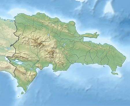
San Rafael del Yuma is a municipality located in the La Altagracia province of the Dominican Republic. It has a population of approximately 46,687 in 2012. The ruins of Juan Ponce de León's residence are located on a plateau located three kilometers from San Rafael de Yuma. The municipality is located 10 kilometers from Boca de Yuma.
San Rafael del Yuma | |
|---|---|
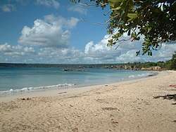 The beach of Boca de Yuma | |
 Seal | |
 San Rafael del Yuma | |
| Coordinates: 18°27′12″N 68°42′36″W | |
| Country | Dominican Republic |
| Province | La Altagracia |
| Founded | 1608 |
| Municipality since | 1904 |
| Area | |
| • Total | 981.2 km2 (378.8 sq mi) |
| Elevation | 26 m (85 ft) |
| Population (2012)[2] | |
| • Total | 46,687 |
| • Density | 48/km2 (120/sq mi) |
| • Demonym | Yumense(a) |
| Municipal Districts | 2 |
Climate
| Climate data for San Rafael del Yuma (1961–1990) | |||||||||||||
|---|---|---|---|---|---|---|---|---|---|---|---|---|---|
| Month | Jan | Feb | Mar | Apr | May | Jun | Jul | Aug | Sep | Oct | Nov | Dec | Year |
| Record high °C (°F) | 34.5 (94.1) |
34.0 (93.2) |
36.0 (96.8) |
36.5 (97.7) |
36.5 (97.7) |
37.8 (100.0) |
39.1 (102.4) |
39.5 (103.1) |
38.6 (101.5) |
36.5 (97.7) |
35.2 (95.4) |
35.0 (95.0) |
39.5 (103.1) |
| Average high °C (°F) | 29.4 (84.9) |
29.9 (85.8) |
31.2 (88.2) |
32.0 (89.6) |
32.6 (90.7) |
33.2 (91.8) |
33.9 (93.0) |
33.9 (93.0) |
33.7 (92.7) |
32.6 (90.7) |
31.0 (87.8) |
29.9 (85.8) |
31.9 (89.4) |
| Average low °C (°F) | 19.1 (66.4) |
19.1 (66.4) |
19.9 (67.8) |
20.3 (68.5) |
22.0 (71.6) |
22.3 (72.1) |
22.9 (73.2) |
23.0 (73.4) |
22.7 (72.9) |
22.2 (72.0) |
21.0 (69.8) |
19.8 (67.6) |
21.2 (70.2) |
| Record low °C (°F) | 12.8 (55.0) |
12.3 (54.1) |
12.1 (53.8) |
10.5 (50.9) |
15.0 (59.0) |
16.0 (60.8) |
16.0 (60.8) |
15.5 (59.9) |
18.1 (64.6) |
18.2 (64.8) |
14.5 (58.1) |
14.0 (57.2) |
10.5 (50.9) |
| Average rainfall mm (inches) | 77.3 (3.04) |
59.7 (2.35) |
70.7 (2.78) |
71.7 (2.82) |
178.3 (7.02) |
98.2 (3.87) |
95.5 (3.76) |
121.7 (4.79) |
149.6 (5.89) |
202.4 (7.97) |
144.9 (5.70) |
95.9 (3.78) |
1,365.9 (53.78) |
| Average rainy days (≥ 1.0 mm) | 9.6 | 8.3 | 7.7 | 6.8 | 11.3 | 9.7 | 10.7 | 10.9 | 11.1 | 13.7 | 11.5 | 11.7 | 123.0 |
| Source: NOAA[3] | |||||||||||||
Sectors
The city is divided into 16 sectors that are,
- Banda Abajo
- Bayahíbe
- Bejucal Abajo
- Boca del Yuma
- Cabo Falso
- Coral
- Gato
- Jaragua Abajo
- La Piñita
- Las Joyas del Mar
- Mata Chalupe
- Punta Papayo
- San José del Yuma
- San Rafael
- Yuma Abajo
- Yuma Arriba
gollark: I think they just removed some events unless you turned on the intents, which shouldn't do that.
gollark: Hmm, were there some gateway changes? I forget.
gollark: Try increasing, decreasing and randomizing the version.
gollark: Are you using dimscord or the other one?
gollark: It's full-featured because it has 2 features and we didn't want the other ones much.
References
- Superficies a nivel de municipios, Oficina Nacional de Estadistica Archived 2009-04-17 at the Wayback Machine
- Censo 2012 de Población y Vivienda, Oficina Nacional de Estadistica
- "San R. Yuma Climate Normals 1961-1990". National Oceanic and Atmospheric Administration. Retrieved September 19, 2016.
| Wikimedia Commons has media related to San Rafael del Yuma (La Altagracia). |
This article is issued from Wikipedia. The text is licensed under Creative Commons - Attribution - Sharealike. Additional terms may apply for the media files.