San Luis Rey, California
San Luis Rey is a neighborhood in Oceanside, California. San Luis Rey is along the San Luis Rey River, 4 miles (6.4 km) northeast of downtown Oceanside. San Luis Rey has a post office with ZIP code 92068, which opened in 1861.[2]
San Luis Rey, California | |
|---|---|
.jpg) 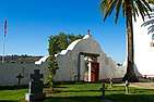 _(cropped).jpg) 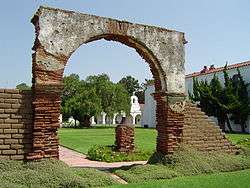 .jpg) | |
 San Luis Rey, California | |
| Coordinates: 33°13′55″N 117°19′25″W | |
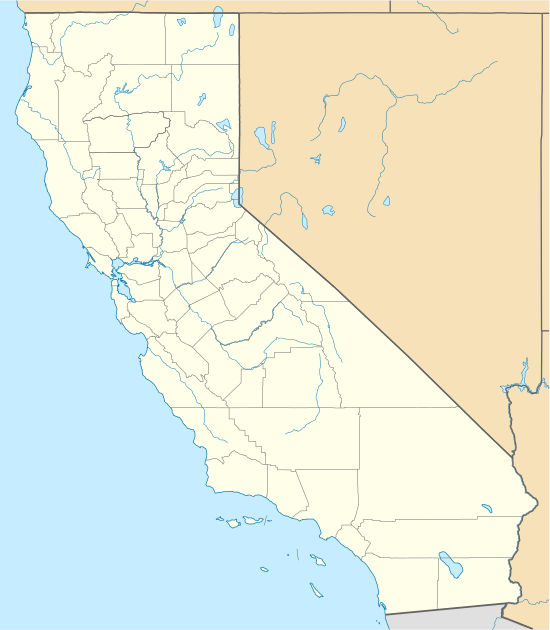
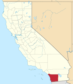
| Country | United States |
| State | California |
| County | San Diego |
| Elevation | 59 ft (18 m) |
| Time zone | UTC-8 (Pacific (PST)) |
| • Summer (DST) | UTC-7 (PDT) |
| ZIP code | 92068 |
| Area code(s) | 442 & 760 |
| GNIS feature ID | 1661386[1] |
History
The area that is now known as San Luis Rey was originally home to Luiseño Indians, who were named after the Mission that was established on their land by the Spanish.[3]
The community was named for Mission San Luis Rey de Francia, established in 1798,[4] which is located near the geographic center of the neighborhood.[5] This Mission at one point covered 950,000 acres and was tended by the Luiseno Indians, who were forcibly moved onto the Mission to work under the Spanish.[3] Due to the extensive and long-lived influence of the Spanish and later the Mexican government, local architecture has taken on a noticeable Spanish and Mexican feel.
The neighborhood also includes the Heritage Park Village and museum, which was the center of town for the city of Oceanside for a time.[3]
The Lilac Fire broke out on December 7, 2017, severely damaging the 240-acre San Luis Rey Downs horse-training facility and killing 46 horses.[6]
Native American culture
The original residents of the valley now called San Luis Rey were Luiseño Indians, also known as the San Luis Rey Band of the Luiseño Indians. Although in other parts of the United States Native Americans were allowed to live autonomously on reservations, such an arrangement was denied to the Luiseño Indians because the settlers wanted to keep the land for farming and ranching. Native Americans were granted US citizenship in 1924.
Since 1996 the band hosts an annual inter-tribal powwow on the San Luis Rey Mission grounds, which is open to the public and presents Native American arts, crafts, food and dancing. On November 28, in honor of National Native American Heritage Month, the San Luis Rey city Council acknowledged the Mission Indians at its council meeting.[4]
Climate
According to the Köppen Climate Classification system, San Luis Rey has a warm-summer Mediterranean climate, abbreviated "Csa" on climate maps.[7]
Demographics
This community has a notably high percentage of US military personnel due to its close proximity to Camp Pendleton.[3]
Notable people
- Robert C. Frazee, California businessman and politician, was born in San Luis Rey.[8]
References
- "US Board on Geographic Names". United States Geological Survey. 2007-10-25. Retrieved 2008-01-31.
- ZIP Code Lookup
- "Oceanside Neighborhood Guide: San Luis Rey | YNC". Your North County. 2014-01-15. Retrieved 2018-04-13.
- "Oceanside recognizes San Luis Rey Band of Mission Indians – The Coast News Group". Retrieved 2019-01-01.
- Durham, David L. (1998). California's Geographic Names: A Gazetteer of Historic and Modern Names of the State. Quill Driver Books. p. 1339. ISBN 1-884995-14-4.
- Union-Tribune (TNS), Bryce Miller The San Diego. "Anniversary of deadly San Luis Rey Downs fire strains still". Valdosta Daily Times. Retrieved 2019-01-01.
- Climate Summary for San Luis Rey, California
- JoinCalifornia.com.-Robert Frazee
| Authority control |
|
|---|