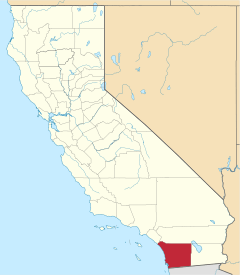
Palomar Mountain, California
Palomar Mountain is an unincorporated community in San Diego County, California, United States.[1]
Palomar Mountain, California | |
|---|---|
 Palomar Mountain Location of Palomar Mountain in California  Palomar Mountain Palomar Mountain (the United States) | |
| Coordinates: 33.3228128°N 116.8786359°W | |
| Country | |
| State | |
| County | |
| Elevation | 1,623 m (5,325 ft) |
| Time zone | UTC-8 (Pacific (PST)) |
| • Summer (DST) | UTC-7 (PDT) |
| Area codes | 442/760 |
| GNIS feature ID | 272859[1] |
Description
The community is located near the north-cental edge of San Diego County within the Cleveland National Forest,[2] southeast of the Palomar Mountain State Park and southwest of Palomar Mountain and the Palomar Observatory.[3]
Climate
According to the Köppen Climate Classification system, Palomar Mountain has a warm-summer Mediterranean climate, abbreviated "Csa" on climate maps. Annual precipitation on the mountain averages about 30 inches (highly variable from year to year), mostly falling between October and March. Snow falls during cold winter storms. Summers are mostly dry, except for occasional thunderstorms in late July to early September. The humid climate supports woods of oak, pine, fir and cedar on large swaths of the mountain.
| Climate data for Palomar Mountain (1981-2010) | |||||||||||||
|---|---|---|---|---|---|---|---|---|---|---|---|---|---|
| Month | Jan | Feb | Mar | Apr | May | Jun | Jul | Aug | Sep | Oct | Nov | Dec | Year |
| Record high °F (°C) | 76 (24) |
75 (24) |
80 (27) |
86 (30) |
92 (33) |
98 (37) |
103 (39) |
110 (43) |
104 (40) |
93 (34) |
85 (29) |
75 (24) |
110 (43) |
| Average high °F (°C) | 52 (11) |
53 (12) |
56 (13) |
61 (16) |
69 (21) |
77 (25) |
85 (29) |
85 (29) |
80 (27) |
70 (21) |
60 (16) |
52 (11) |
66.7 (19.3) |
| Daily mean °F (°C) | 41 (5) |
42 (6) |
44 (7) |
48 (9) |
55 (13) |
62 (17) |
70 (21) |
69 (21) |
64 (18) |
54 (12) |
46 (8) |
40 (4) |
52.9 (11.6) |
| Average low °F (°C) | 29 (−2) |
30 (−1) |
32 (0) |
35 (2) |
40 (4) |
47 (8) |
54 (12) |
53 (12) |
47 (8) |
38 (3) |
32 (0) |
27 (−3) |
38.7 (3.7) |
| Record low °F (°C) | −4 (−20) |
4 (−16) |
10 (−12) |
20 (−7) |
22 (−6) |
27 (−3) |
34 (1) |
33 (1) |
23 (−5) |
15 (−9) |
10 (−12) |
−1 (−18) |
−4 (−20) |
| Average rainfall inches (mm) | 5.5 (140) |
6.8 (170) |
5.8 (150) |
2.7 (69) |
0.7 (18) |
0.2 (5.1) |
0.4 (10) |
0.8 (20) |
0.7 (18) |
1.9 (48) |
3.3 (84) |
4.9 (120) |
33.7 (860) |
| Average snowfall inches (cm) | 6.8 (17) |
7.5 (19) |
9.4 (24) |
4.0 (10) |
0.4 (1.0) |
0 (0) |
0 (0) |
0 (0) |
0 (0) |
0.2 (0.51) |
1.8 (4.6) |
5.4 (14) |
35.5 (90) |
| Source 1: [4] | |||||||||||||
| Source 2: [5] | |||||||||||||
See also
![]()
References
- U.S. Geological Survey Geographic Names Information System: Palomar Mountain
- "MyTopo Maps - Palomar Mountain, CA, USA" (Map). mytopo.com. Trimble Navigation, Ltd. Retrieved 4 Sep 2018.
- Google (4 Sep 2018). "Palomar Mountain, California" (Map). Google Maps. Google. Retrieved 4 Sep 2018.
- "Monthly Average/Record Temperatures". weather.com. Retrieved 6 August 2015.
- "Period of Record Monthly Climate Summary". Western Regional Climate Center. Retrieved 6 August 2015.
