San Demetrio ne' Vestini
San Demetrio ne'Vestini is a comune and town in the Province of L'Aquila in the Abruzzo region of Italy
San Demetrio ne' Vestini | |
|---|---|
| Comune di San Demetrio ne' Vestini | |
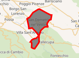
Location of San Demetrio ne' Vestini 
| |
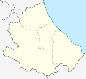
 San Demetrio ne' Vestini Location of San Demetrio ne' Vestini in Italy  San Demetrio ne' Vestini San Demetrio ne' Vestini (Abruzzo) | |
| Coordinates: 42°17′26″N 13°33′22″E | |
| Country | Italy |
| Region | Abruzzo |
| Province | L'Aquila (AQ) |
| Frazioni | Cardabello, Cardamone, Cavantoni, Collarano, Colle, San Giovanni, Stiffe, Villagrande |
| Area | |
| • Total | 16.33 km2 (6.31 sq mi) |
| Elevation | 662 m (2,172 ft) |
| Population (1 January 2007)[2] | |
| • Total | 1,755 |
| • Density | 110/km2 (280/sq mi) |
| Demonym(s) | Sandemetrani |
| Time zone | UTC+1 (CET) |
| • Summer (DST) | UTC+2 (CEST) |
| Postal code | 67028 |
| Dialing code | 0862 |
| ISTAT code | 066087 |
| Patron saint | San Demetrio |
| Saint day | 26 October |
| Website | Official website |
In the 18th century, San Demetrio ne' Vestini was ruled by Duke Filippo Arcamone. His son Vincenzo later became the last duke of the town and died with no heirs.[3]
Transport
San Demetrio has a station on the Terni–Sulmona railway, with trains to L'Aquila and Sulmona.
gollark: Which bit are you calling "you" here?
gollark: Well, you would probably die at some point as the... brain parts... run out of stored glucose.
gollark: > 222 new messagesÆÆÆÆÆÆÆ
gollark: What a somewhat unique cosmic horror thing.
gollark: If the companies wanted to use them as handheld lasers they probably could quite easily.
References
- "Superficie di Comuni Province e Regioni italiane al 9 ottobre 2011". Istat. Retrieved 16 March 2019.
- All demographics and other statistics from the Italian statistical institute (Istat)
- Famiglia Arcamone, Nobili Napoletani, from La Storia Dietro Gli Scudi (2007).
This article is issued from Wikipedia. The text is licensed under Creative Commons - Attribution - Sharealike. Additional terms may apply for the media files.