Salur
Salur or Saluru is a municipal town and mandal headquarters in Vizianagaram district, of the Indian state of Andhra Pradesh.
Salur | |
|---|---|
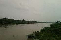
 Vegavathi river at Salur | |
.svg.png) Salur Location in Andhra Pradesh, India | |
| Coordinates: 18.5333°N 83.2167°E | |
| Country | India |
| State | Andhra Pradesh |
| District | Vizianagaram |
| Government | |
| • Type | Municipality |
| • Body | Salur Municipality, BUDA |
| Area | |
| • Total | 19.55 km2 (7.55 sq mi) |
| Elevation | 138.05 m (452.92 ft) |
| Population (2011)[2] | |
| • Total | 49,500 |
| • Density | 2,500/km2 (6,600/sq mi) |
| Languages | |
| • Official | Telugu |
| Time zone | UTC+5:30 (IST) |
| PIN | 535 591 |
| Telephone code | 91–8964 |
| Website | Salur Municipality |
Geography
Salur is on the banks of River Vegavathi at 18.5333°N 83.2167°E.[3] It has an average elevation of 118 metres (387 ft). It is bounded by Makkuva, Bobbili, Ramabhadrapuram and Pachipenta mandals of Andhra Pradesh state. Salur is surrounded with green forests and chains of hills on two sides and by River Vegavathi on the other two.
The climate of the town is generally characterized by high humidity almost all round the year, oppressive summer, and seasonal rainfall. The temperature varies between 17 and 40 degrees of Celsius. Average annual rainfall is 1074.0 mm. The nature of the soil is generally black cotton soil.
Demographics
As of 2011 Census of India, the town had a population of 49,500. The total population constitutes 24,021 males, 25,479 females and 4,900 children (age 0–6 years). The average literacy rate stands at 73.22% with 32,656 literates, approximately equal to the national average of 73.00%.[4]
Administration
Municipality
Salur was a major panchayat till 1950. It was established in 1950 and was upgraded as grade II municipality in 2001. The extent of Salur municipality area is 19.55 sq mi (50.6 km2).
The source of water supply is River Vegavathi, with 200 public taps and 226 public bore–wells. The municipality supplies 3 million litres per day of total drinking water is supplied with a per capita of 80 litres per day. The municipality has 54 km (34 mi) of roads, 4 public parks, 5 playgrounds, 11 community halls etc. There are 23 elementary and 2 secondary schools for education purpose.[5]
Legislative Assembly
Andhra Pradesh Legislative Assembly Constituency of Salur is reserved for Scheduled Tribes.
Education
The primary and secondary school education is imparted by government, aided and private schools, under the state School Education Department.[6][7] The medium of instruction followed by schools are English and Telugu.
See also
- List of municipalities in Andhra Pradesh
References
- "Welcome to Salur Municipality". Commissioner & Director of Municipal Administration. Municipal Administration & Urban Development Department, Govt. of Andhra Pradesh. Retrieved 19 August 2014.
- "Census of India Search details". censusindia.gov.in. Archived from the original on 18 May 2015. Retrieved 10 May 2015.
- Falling Rain Genomics, Inc - Salur
- "Chapter–3 (Literates and Literacy rate)" (PDF). Registrar General and Census Commissioner of India. Retrieved 19 August 2014.
- "Public services/amenities". Commissioner & Director of Municipal Administration. Municipal Administration & Urban Development Department, Govt. of Andhra Pradesh. Retrieved 19 August 2014.
- "School Education Department" (PDF). School Education Department, Government of Andhra Pradesh. Archived from the original (PDF) on 27 December 2015. Retrieved 7 November 2016.
- "The Department of School Education - Official AP State Government Portal | AP State Portal". www.ap.gov.in. Archived from the original on 7 November 2016. Retrieved 7 November 2016.