Saluda Township, Jefferson County, Indiana
Saluda Township is one of ten townships in Jefferson County, Indiana, United States. As of the 2010 census, its population was 1,370 and it contained 619 housing units.[1] It was created by the Jefferson County Court of Common Pleas on Feb. 13, 1817. Saluda is derived from a Native American name meaning "river of corn".[2]
Saluda Township | |
|---|---|
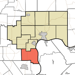 Location in Jefferson County | |
| Coordinates: 38°37′37″N 85°30′09″W | |
| Country | United States |
| State | Indiana |
| County | Jefferson |
| Government | |
| • Type | Indiana township |
| Area | |
| • Total | 37.69 sq mi (97.6 km2) |
| • Land | 37.35 sq mi (96.7 km2) |
| • Water | 0.34 sq mi (0.9 km2) 0.90% |
| Elevation | 774 ft (236 m) |
| Population (2010) | |
| • Total | 1,370 |
| • Density | 36.7/sq mi (14.2/km2) |
| GNIS feature ID | 0453830 |
Geography
According to the 2010 census, the township has a total area of 37.69 square miles (97.6 km2), of which 37.35 square miles (96.7 km2) (or 99.10%) is land and 0.34 square miles (0.88 km2) (or 0.90%) is water.[1] The streams of Big Saluda Creek, Farley Creek, Harts Falls Creek and Lee Creek run through this township.
Unincorporated towns
Adjacent townships
- Hanover Township (north)
- Bethlehem Township, Clark County (southeast)
- Washington Township, Clark County (southwest)
- Lexington Township, Scott County (west)
- Republican Township (northwest)
Cemeteries
The township contains the following cemeteries: Barnes, Harrell (also called Fairview), Maddox, Marble Hill (also called Bowman), Marling, Mt. Zion, New Bethel Methodist Church, New Prospect, Swan
Major highways
References
- "Population, Housing Units, Area, and Density: 2010 - County -- County Subdivision and Place -- 2010 Census Summary File 1". United States Census. Archived from the original on 2020-02-12. Retrieved 2013-05-10.
- Baker, Ronald L. (October 1995). From Needmore to Prosperity: Hoosier Place Names in Folklore and History. Indiana University Press. p. 293. ISBN 978-0-253-32866-3.
...originally was a Native American stream name meaning "river of corn."
External links
Municipalities and communities of Jefferson County, Indiana, United States | ||
|---|---|---|
| City | Map of Indiana highlighting Jefferson County | |
| Towns | ||
| Townships | ||
| CDPs | ||
| Other unincorporated communities | ||
| Footnotes | ‡This populated place also has portions in an adjacent county or counties | |