Salt Lick Township, Perry County, Ohio
Salt Lick Township is one of the fourteen townships of Perry County, Ohio, United States. The 2000 census found 1,200 people in the township, 450 of whom lived in the unincorporated portions of the township.[3]
Salt Lick Township, Perry County, Ohio | |
|---|---|
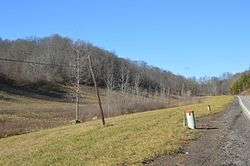 Along State Route 155 between Hemlock and Shanwee | |
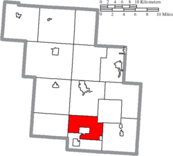 Location of Salt Lick Township in Perry County | |
| Coordinates: 39°36′32″N 82°12′6″W | |
| Country | United States |
| State | Ohio |
| County | Perry |
| Area | |
| • Total | 20.7 sq mi (53.6 km2) |
| • Land | 20.7 sq mi (53.5 km2) |
| • Water | 0.0 sq mi (0.1 km2) |
| Elevation | 942 ft (287 m) |
| Population (2000) | |
| • Total | 1,200 |
| • Density | 58.1/sq mi (22.4/km2) |
| Time zone | UTC-5 (Eastern (EST)) |
| • Summer (DST) | UTC-4 (EDT) |
| FIPS code | 39-70226[2] |
| GNIS feature ID | 1086790[1] |
Geography
Located in the southern part of the county, it borders the following townships:
- Pike Township - north
- Pleasant Township - northeast
- Monroe Township - east
- Coal Township - south
- Monday Creek Township - west
- Jackson Township - northwest corner
Two villages are located in Salt Lick Township: Shawnee in its center, and Hemlock in its southeast corner.
Name and history
Salt Lick Township was organized around 1823, and named for the mineral licks within its borders.[4] It is the only Salt Lick Township statewide.[5]
Government
The township is governed by a three-member board of trustees, who are elected in November of odd-numbered years to a four-year term beginning on the following January 1. Two are elected in the year after the presidential election and one is elected in the year before it. There is also an elected township fiscal officer,[6] who serves a four-year term beginning on April 1 of the year after the election, which is held in November of the year before the presidential election. Vacancies in the fiscal officership or on the board of trustees are filled by the remaining trustees.
References
- "US Board on Geographic Names". United States Geological Survey. 2007-10-25. Retrieved 2008-01-31.
- "U.S. Census website". United States Census Bureau. Retrieved 2008-01-31.
- Perry County, Ohio — Population by Places Estimates Ohio State University, 2007. Accessed 15 May 2007.
- Colborn, Ephraim S. (1883). History of Fairfield and Perry Counties, Ohio. Brookhaven Press. p. 302.
- "Detailed map of Ohio" (PDF). United States Census Bureau. 2000. Retrieved 2007-02-16.
- §503.24, §505.01, and §507.01 of the Ohio Revised Code. Accessed 4/30/2009.
External links
Municipalities and communities of Perry County, Ohio, United States | ||
|---|---|---|
| Villages | 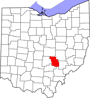 Map of Ohio highlighting Perry County | |
| Townships | ||
| CDPs | ||
| Unincorporated communities | ||
| Ghost towns | ||
| Footnotes | ‡This populated place also has portions in an adjacent county or counties | |
| Authority control |
|
|---|