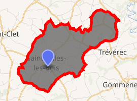
Saint-Gilles-les-Bois
Saint-Gilles-les-Bois (Breton: Sant-Jili-ar-C'hoad) is a commune in the Côtes-d'Armor department of Brittany in northwestern France.
Saint-Gilles-les-Bois Sant-Jili-ar-C'hoad | |
|---|---|
The church of Saint-Gilles, in Saint-Gilles-les-Bois | |
Location of Saint-Gilles-les-Bois 
| |
 Saint-Gilles-les-Bois  Saint-Gilles-les-Bois | |
| Coordinates: 48°39′02″N 3°06′06″W | |
| Country | France |
| Region | Brittany |
| Department | Côtes-d'Armor |
| Arrondissement | Guingamp |
| Canton | Plouha |
| Intercommunality | Lanvollon Plouha |
| Government | |
| • Mayor (2014–2020) | Philippe Planté |
| Area 1 | 9.45 km2 (3.65 sq mi) |
| Population (2017-01-01)[1] | 432 |
| • Density | 46/km2 (120/sq mi) |
| Time zone | UTC+01:00 (CET) |
| • Summer (DST) | UTC+02:00 (CEST) |
| INSEE/Postal code | 22293 /22290 |
| Elevation | 39–100 m (128–328 ft) |
| 1 French Land Register data, which excludes lakes, ponds, glaciers > 1 km2 (0.386 sq mi or 247 acres) and river estuaries. | |
Population
| Year | Pop. | ±% |
|---|---|---|
| 1836 | 1,020 | — |
| 1841 | 955 | −6.4% |
| 1851 | 1,045 | +9.4% |
| 1856 | 1,031 | −1.3% |
| 1861 | 1,050 | +1.8% |
| 1866 | 1,047 | −0.3% |
| 1872 | 970 | −7.4% |
| 1876 | 983 | +1.3% |
| 1881 | 824 | −16.2% |
| 1886 | 905 | +9.8% |
| 1896 | 927 | +2.4% |
| 1906 | 744 | −19.7% |
| 1911 | 828 | +11.3% |
| 1921 | 639 | −22.8% |
| 1926 | 608 | −4.9% |
| 1931 | 600 | −1.3% |
| 1936 | 539 | −10.2% |
| 1982 | 451 | −16.3% |
| 1990 | 421 | −6.7% |
| 1999 | 401 | −4.8% |
| 2008 | 417 | +4.0% |
Inhabitants of Saint-Gilles-les-Bois are called saint-gillois in French.
gollark: Hey gibson, vote gibson.
gollark: <@319753218592866315> VOTE GIBSON
gollark: We don't have moooosey or anima or cyber yet, though?
gollark: How many votes do we have so far? How many random people do I need to ping?
gollark: Vote Gibson. Be like Camto. !lyricly!demote!
External links
| Wikimedia Commons has media related to Saint-Gilles-les-Bois. |
- Official website (in French)
- French Ministry of Culture list for Saint-Gilles-les-Bois (in French)
This article is issued from Wikipedia. The text is licensed under Creative Commons - Attribution - Sharealike. Additional terms may apply for the media files.