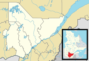
Sagard, Quebec
Sagard is an unorganized territory and hamlet in the Capitale-Nationale region of Quebec, Canada, part of the Charlevoix-Est Regional County Municipality. The hamlet of Sagard (48°01′47″N 70°04′02″W) is located on the eastern banks of the Little Saguenay River, along Route 170 between Saint-Siméon and Petit-Saguenay.
Sagard | |
|---|---|
Unorganized territory | |
 Location within Charlevoix-Est RCM | |
 Sagard Location in central Quebec | |
| Coordinates: 48°02′N 70°04′W[1] | |
| Country | Canada |
| Province | Quebec |
| Region | Capitale-Nationale |
| RCM | Charlevoix-Est |
| Constituted | unspecified |
| Government | |
| • Federal riding | Montmorency—Charlevoix —Haute-Côte-Nord |
| • Prov. riding | Charlevoix–Côte-de-Beaupré |
| Area | |
| • Total | 211.80 km2 (81.78 sq mi) |
| • Land | 207.04 km2 (79.94 sq mi) |
| Population (2011)[3] | |
| • Total | 117 |
| • Density | 0.6/km2 (2/sq mi) |
| • Pop 2006-2011 | |
| • Dwellings | 64 |
| Time zone | UTC−5 (EST) |
| • Summer (DST) | UTC−4 (EDT) |
| Area code(s) | 418 and 581 |
| Highways | |
Geography
The territory is characterized by a hilly terrain, dotted with many small lakes. Its elevation ranges from 274 meters (899 ft) at Lake David in the north-east, to 640 meters (2,100 ft) at the summit of Mount Chicot.[4]
History
The territory and hamlet are named after the geographic township of Sagard, which was proclaimed in 1919 and named in honour of Théodat Sagard, a missionary of the Recollects order who is mainly remembered for his writings on New France and the Hurons.[4]
Demographics
| Year | Pop. | ±% |
|---|---|---|
| 1991 | 223 | — |
| 1996 | 165 | −26.0% |
| 2001 | 160 | −3.0% |
| 2006 | 143 | −10.6% |
| 2011 | 117 | −18.2% |
| Source: [5] | ||
Private dwellings occupied by usual residents: 50 (total dwellings: 64)
Notable residents
The Desmarais family has a large estate in Sagard.
References
- Reference number 149770 of the Commission de toponymie du Québec (in French)
- Ministère des Affaires municipales, des Régions et de l'Occupation du territoire - Répertoire des municipalités: Sagard
- Statistics Canada 2011 Census - Sagard census profile
- "Sagard (canton)" (in French). Commission de toponymie du Québec. Retrieved 2009-05-25.
- Statistics Canada: 1996, 2001, 2006, 2011 census