Sơn Động District
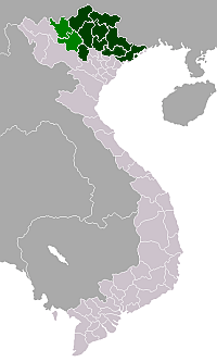
Sơn Động District is a rural district of Bắc Giang Province in the Northeast region of Vietnam. It is the easternmost district in the province. As of 2018 it had a population of 72,350.[2] The district covers an area of 844 km². The district capital lies at An Châu.[2] There are some cultural sites here such as: Chẽ pagoda, Female King temple, Lục Liễu temple, Đặng temple and Chẽ temple.
Sơn Động District Huyện Sơn Động | |
|---|---|
| Country | |
| Province | Bắc Giang |
| Capital | An Châu |
| Government | |
| • Party Secretary: | Nghiêm Xuân Hưởng[1] |
| • People's Council Chairman: | Nguyễn Quang Ngạn |
| • People's Committee Chairman: | Hoàng My Ca |
| Area | |
| • Total | 326 sq mi (844 km2) |
| Population | |
| • Total | 72,350 |
| Time zone | UTC+7 (Indochina Time) |
Administrative divisions
The district is divided administratively into two townships, An Châu (district capital) and Tây Yên Tử, and the communes of: Hữu Sản, An Lạc, Vân Sơn, Lệ Viễn, Vĩnh An, Dương Hưu, Long Sơn, An Bá, Yên Định, Tuấn Đạo, Thanh Luận, Cẩm Đàn, Giáo Liêm, Đại Sơn and Phúc Sơn.
121.72 km² in the southern portion of the district has been designated as the Tây Yên Tử Nature Reserve.[3][4]
References
- http://www.bacgiang.gov.vn/email/c-210/timkiem.html&c=0
- "Districts of Vietnam". Statoids. Retrieved March 13, 2009.
- "Tay Yen Tu in Viet Nam". Protected Planet. Archived from the original on 31 July 2018.
- Minh Quý Hà (2010). Khu bảo tồn thiên nhiên Tây Yên Tử: giá trị bảo tồn đa dạng sinh học và tiềm năng phát triển [Tây Yên Tử Nature Reserve: biodiversity conservation value and development potential] (in Vietnamese). Hanoi: Natural Science and Technology Publishing House. OCLC 864366107.
