Rudolph, Ohio
Rudolph is an unincorporated community and census-designated place (CDP) in eastern Liberty Township, Wood County, Ohio, United States. As of the 2010 census, it had a population of 458.[1] Although it is unincorporated, it has a post office, with the ZIP code of 43462.[2]
Rudolph, Ohio | |
|---|---|
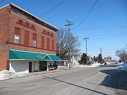 Main Street in Rudolph, Ohio, showing the local post office | |
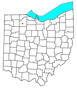 Location of Rudolph, Ohio | |
| Coordinates: 41°17′52″N 83°40′11″W | |
| Country | United States |
| State | Ohio |
| County | Wood |
| Area | |
| • Total | 0.8 sq mi (2.1 km2) |
| • Land | 0.8 sq mi (2.1 km2) |
| • Water | 0 sq mi (0 km2) |
| Population (2010) | |
| • Total | 458 |
| • Density | 560/sq mi (220/km2) |
| Time zone | UTC-5 (Eastern (EST)) |
| • Summer (DST) | UTC-4 (EDT) |
| ZIP code | 43462 |
| Area code(s) | 419 |
History
Rudolph was originally called Mercers, and under the latter was platted in 1890 and named for Daniel Mercer, proprietor.[3] A post office called Rudolph has been in operation since 1891.[4] The present name honors H. J. Rudolph, a town merchant.[3]
The post office in Rudolph has been offering a special Christmas postmark since 1990. According to the Toledo Blade in 2014, "Charlotte Lamb, the officer in charge at the Rudolph post office... estimates between 75,000 and 100,000 parcels come through the office every year."[5][6]
Geography
Rudolph is located at 41°17′52″N 83°40′11″W and is 6 miles (10 km) south of Bowling Green. According to the U.S. Census Bureau, the CDP has an area of 0.81 square miles (2.1 km2), all land.[1]
Rudolph is connected to Bowling Green and North Baltimore by the Slippery Elm Trail.
References
- "Geographic Identifiers: 2010 Demographic Profile Data (G001): Rudolph CDP, Ohio". U.S. Census Bureau, American Factfinder. Archived from the original on February 12, 2020. Retrieved January 22, 2013.
- Zip Code Lookup
- Leeson, Michael A. (1897). Commemorative Historical and Biographical Record of Wood County, Ohio: Its Past and Present, Early Settlement and Development. J.H. Beers & Company. p. 309.
- "Wood County". Jim Forte Postal History. Retrieved 12 January 2016.
- http://www.toledoblade.com/local/2014/11/29/Postal-Service-honors-Rudolph.html
- "U.S. Post Office Volunteers In Rudolph, Ohio Town Save Rudolph Postmark". Retrieved 19 December 2014.
Municipalities and communities of Wood County, Ohio, United States | ||
|---|---|---|
| Cities | 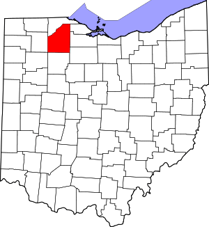 Map of Ohio highlighting Wood County | |
| Villages | ||
| Townships | ||
| CDPs | ||
| Other unincorporated communities | ||
| Footnotes | ‡This populated place also has portions in an adjacent county or counties | |