Rossmoor, New Jersey
Rossmoor is an unincorporated community and census-designated place (CDP) located within Monroe Township in Middlesex County, New Jersey, United States.[6][7][8] As of the 2010 United States Census, the CDP's population was 2,666.[3]
Rossmoor, New Jersey | |
|---|---|
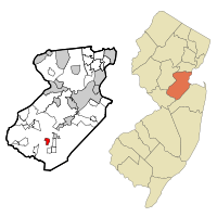
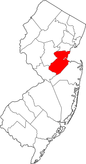
 Map of Rossmoor highlighted within Middlesex County. Right: Location of Middlesex County in New Jersey. | |
| Coordinates: 40.332747°N 74.472422°W | |
| Country | |
| State | |
| County | Middlesex |
| Township | Monroe |
| Area | |
| • Total | 0.918 sq mi (2.378 km2) |
| • Land | 0.904 sq mi (2.343 km2) |
| • Water | 0.014 sq mi (0.035 km2) 1.48% |
| Elevation | 131 ft (40 m) |
| Population | |
| • Total | 2,666 |
| • Density | 2,947.6/sq mi (1,138.1/km2) |
| Time zone | UTC-5 (Eastern (EST)) |
| • Summer (DST) | UTC-4 (Eastern (EDT)) |
| Area code(s) | 609 |
| FIPS code | 3464865[1][4] |
| GNIS feature ID | 02389783[1][5] |
Rossmoor is a gated age-restricted co-op, active adult community . Rossmoor covers 418 acres (1.69 km2) just off Exit 8A of the New Jersey Turnpike (Interstate 95). It has 2,303 residences, encircling a 104-acre (0.42 km2) championship golf course. The community offers a wide selection of living space, from smaller units of 500 sq ft (46 m2), to larger units with 2,300 sq ft (210 m2) of living space, with its architecture primarily being American Colonial in style. Many residents continue to work in the area or commute to New York City. Express buses stop at Rossmoor for the 55-minute ride to the Port Authority Bus Terminal on 42nd Street in Midtown Manhattan.
Geography
According to the United States Census Bureau, the CDP had a total area of 0.918 square miles (2.378 km2), including 0.904 square miles (2.343 km2) of land and 0.014 square miles (0.035 km2) of water (1.48%).[1][9]
Demographics
| Historical population | |||
|---|---|---|---|
| Census | Pop. | %± | |
| 1990 | 3,231 | — | |
| 2000 | 3,129 | −3.2% | |
| 2010 | 2,666 | −14.8% | |
| Population sources: 2000[10] 2010[3] | |||
Census 2010
The 2010 United States Census counted 2,666 people, 1,966 households, and 617.324 families in the CDP. The population density was 2,947.6 per square mile (1,138.1/km2). There were 2,257 housing units at an average density of 2,495.4 per square mile (963.5/km2). The racial makeup was 93.96% (2,505) White, 4.31% (115) Black or African American, 0.08% (2) Native American, 1.01% (27) Asian, 0.00% (0) Pacific Islander, 0.15% (4) from other races, and 0.49% (13) from two or more races. Hispanic or Latino of any race were 2.63% (70) of the population.[3]
Of the 1,966 households, 0.0% had children under the age of 18; 27.3% were married couples living together; 3.5% had a female householder with no husband present and 68.6% were non-families. Of all households, 65.5% were made up of individuals and 57.6% had someone living alone who was 65 years of age or older. The average household size was 1.36 and the average family size was 2.03.[3]
0.0% of the population were under the age of 18, 0.1% from 18 to 24, 0.8% from 25 to 44, 16.4% from 45 to 64, and 82.7% who were 65 years of age or older. The median age was 77.9 years. For every 100 females, the population had 50.6 males. For every 100 females ages 18 and older there were 50.6 males.[3]
Census 2000
As of the 2000 United States Census[4] there were 3,129 people, 2,131 households, and 790 families living in the CDP. The population density was 1,342.3/km2 (3,466.9/mi2). There were 2,345 housing units at an average density of 1,006.0/km2 (2,598.2/mi2). The racial makeup of the CDP was 97.95% White, 0.96% African American, 0.10% Native American, 0.51% Asian, 0.06% from other races, and 0.42% from two or more races. Hispanic or Latino of any race were 0.51% of the population.[10]
There were 2,131 households out of which none had children under the age of 18 living with them, 33.8% were married couples living together, 2.6% had a female householder with no husband present, and 62.9% were non-families. 61.1% of all households were made up of individuals and 56.4% had someone living alone who was 65 years of age or older. The average household size was 1.40 and the average family size was 2.03.[10]
In the CDP the population was spread out with 0.1% under the age of 18, 0.1% from 18 to 24, 0.6% from 25 to 44, 9.8% from 45 to 64, and 89.5% who were 65 years of age or older. The median age was 77 years. For every 100 females, there were 50.1 males. For every 100 females age 18 and over, there were 50.1 males.[10]
The median income for a household in the CDP was $33,104, and the median income for a family was $41,847. Males had a median income of $65,385 versus $38,750 for females. The per capita income for the CDP was $31,178. About 1.1% of families and 4.3% of the population were below the poverty line, including none of those under age 18 and 3.1% of those age 65 or over.[10]
References
- Gazetteer of New Jersey Places, United States Census Bureau. Accessed July 21, 2016.
- U.S. Geological Survey Geographic Names Information System: Rossmoor Park Census Designated Place, Geographic Names Information System. Accessed November 28, 2012.
- DP-1 - Profile of General Population and Housing Characteristics: 2010 Demographic Profile Data for Rossmoor CDP, New Jersey, United States Census Bureau. Accessed November 28, 2012.
- U.S. Census website, United States Census Bureau. Accessed September 4, 2014.
- US Board on Geographic Names, United States Geological Survey. Accessed September 4, 2014.
- New Jersey: 2010 - Population and Housing Unit Counts - 2010 Census of Population and Housing (CPH-2-32), United States Census Bureau, August 2012. Accessed November 28, 2012.
- GCT-PH1 - Population, Housing Units, Area, and Density: 2010 - County -- County Subdivision and Place from the 2010 Census Summary File 1 for Middlesex County, New Jersey Archived 2020-02-12 at Archive.today, United States Census Bureau. Accessed November 28, 2012.
- Locality Search, State of New Jersey. Accessed April 19, 2015.
- US Gazetteer files: 2010, 2000, and 1990, United States Census Bureau. Accessed September 4, 2014.
- DP-1 - Profile of General Demographic Characteristics: 2000 from the Census 2000 Summary File 1 (SF 1) 100-Percent Data for Rossmoor CDP, New Jersey Archived 2020-02-12 at Archive.today, United States Census Bureau. Accessed November 28, 2012.
