Roselle Township, Carroll County, Iowa
Roselle Township is one of eighteen townships in Carroll County, Iowa, USA. As of the 2000 census, its population was 670.
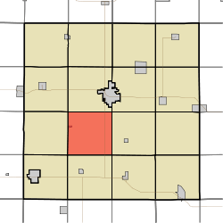
Roselle Township, Carroll County | |
|---|---|
 | |
| Coordinates: 41°59′25″N 094°55′08″W | |
| Country | |
| State | |
| County | Carroll |
| Area | |
| • Total | 35.19 sq mi (91.14 km2) |
| • Land | 35.19 sq mi (91.14 km2) |
| • Water | 0 sq mi (0 km2) |
| Elevation | 1,332 ft (406 m) |
| Population (2000) | |
| • Total | 670 |
| • Density | 19/sq mi (7.4/km2) |
| FIPS code | 19-93699[2] |
| GNIS feature ID | 0468642 |
Geography
Roselle Township covers an area of 35.19 square miles (91.1 km2) and contains one incorporated settlement, Halbur. According to the USGS, it contains two cemeteries: Holy Angels and Saint Augustine.
gollark: Calculators seem weirdly expensive for what you get. Fancier ones anyway.
gollark: It has nice features, though the UI can sometimes be annoying.
gollark: <@163109867953979392> I use a Casio FX-991EX, though those might be more of a Europe thing.
gollark: It seems so, based on testing exactly two things.
gollark: I wonder if it does the same with other things?
References
- "US Board on Geographic Names". United States Geological Survey. 2007-10-25. Retrieved 2008-01-31.
- "U.S. Census website". United States Census Bureau. Retrieved 2008-01-31.
External links
Municipalities and communities of Carroll County, Iowa, United States | ||
|---|---|---|
| Cities | Map of Iowa highlighting Carroll County | |
| Townships | ||
| Unincorporated communities | ||
| Footnotes | ‡This populated place also has portions in an adjacent county or counties | |
This article is issued from Wikipedia. The text is licensed under Creative Commons - Attribution - Sharealike. Additional terms may apply for the media files.