Rocky Boy West, Montana
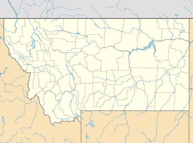
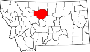
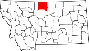
Rocky Boy West is a census-designated place (CDP) in Hill and Chouteau counties in the U.S. state of Montana. The population was 890 at the 2010 census.[1]
Rocky Boy West, Montana | |
|---|---|
 Rocky Boy West | |
| Coordinates: 48°17′58″N 109°59′49″W | |
| Country | United States |
| State | Montana |
| Counties | Chouteau, Hill |
| Area | |
| • Total | 5.4 sq mi (14.1 km2) |
| • Land | 5.4 sq mi (14.1 km2) |
| • Water | 0.0 sq mi (0.0 km2) |
| Elevation | 2,753 ft (839 m) |
| Population (2010) | |
| • Total | 890 |
| • Density | 163/sq mi (63.0/km2) |
| Time zone | UTC-7 (Mountain (MST)) |
| • Summer (DST) | UTC-6 (MDT) |
| Area code(s) | 406 |
| FIPS code | 30-63928 |
| GNIS feature ID | 2585653 |
Geography
Parker School is located in southeastern Hill County and northeastern Chouteau County at 48°17′58″N 109°59′49″W, in the northwest part of the Rocky Boy Indian Reservation. It is bordered by the community of Box Elder to the northwest. U.S. Route 87 crosses the northwest corners of the CDP, leading northeast 23 miles (37 km) to Havre and southwest 48 miles (77 km) to Fort Benton.
According to the United States Census Bureau, the Parker School CDP has a total area of 5.4 square miles (14.1 km2), all land.[1]
gollark: Unfortunately, my excellent code appears to not work properly.```c#include <stdio.h>#include <signal.h>#include <string.h>#include <stdlib.h>#include <sys/mman.h>#include <unistd.h>static void handler(int sig, siginfo_t *info, void *utterly_worthless_argument) { printf("oh bees segfault %08x\n", info->si_addr); int ps = getpagesize(); long ad = (long)info->si_addr; ad = ad - (ad % ps); mmap((void*)ad, 0x10000, PROT_NONE, MAP_ANONYMOUS|MAP_FIXED, -1, 0);}int main() { struct sigaction sa; sigemptyset(&sa.sa_mask); sa.sa_flags = SA_NODEFER; sa.sa_sigaction = handler; sigaction(SIGSEGV, &sa, NULL); *(int*)NULL = -3; printf("thing done\n"); return 0;}```
gollark: Why are people not arbitraging this?
gollark: I don't think you can do that without extra hardware.
gollark: No.
gollark: ffmpeg and other tools dealing with video encoding will have options for it.
References
- "Geographic Identifiers: 2010 Demographic Profile Data (G001): Rocky Boy West CDP, Montana". U.S. Census Bureau, American Factfinder. Archived from the original on February 12, 2020. Retrieved October 15, 2014.
This article is issued from Wikipedia. The text is licensed under Creative Commons - Attribution - Sharealike. Additional terms may apply for the media files.

