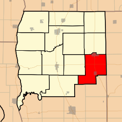
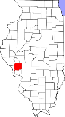
Rockbridge Township, Greene County, Illinois
Rockbridge Township is one of thirteen townships in Greene County, Illinois, USA. As of the 2010 census, its population was 1,633 and it contained 761 housing units.[2]
Rockbridge Township | |
|---|---|
 Location in Greene County | |
 Greene County's location in Illinois | |
| Coordinates: 39°17′18″N 90°12′50″W | |
| Country | United States |
| State | Illinois |
| County | Greene |
| Established | November 4, 1884 |
| Area | |
| • Total | 47.77 sq mi (123.7 km2) |
| • Land | 47.66 sq mi (123.4 km2) |
| • Water | 0.12 sq mi (0.3 km2) 0.25% |
| Elevation | 515 ft (157 m) |
| Population (2010) | |
| • Estimate (2016)[1] | 1,523 |
| • Density | 34.3/sq mi (13.2/km2) |
| Time zone | UTC-6 (CST) |
| • Summer (DST) | UTC-5 (CDT) |
| ZIP codes | 62016, 62044, 62081, 62630 |
| FIPS code | 17-061-64824 |
Geography
According to the 2010 census, the township has a total area of 47.77 square miles (123.7 km2), of which 47.66 square miles (123.4 km2) (or 99.77%) is land and 0.12 square miles (0.31 km2) (or 0.25%) is water.[2]
Cities, towns, villages
- Greenfield (vast majority)
- Rockbridge
Unincorporated towns
- Fayette at 39.320047°N 90.153723°W
(This list is based on USGS data and may include former settlements.)
Cemeteries
The township contains these ten cemeteries: Cannedy, Freer, Hudson, Mitchell, Rives, Taylor Creek, Weisner, Whitlock, Witt and Witt Number 1.
Major highways
Airports and landing strips
- Sunset Landing Strip
School districts
- Greenfield Community Unit School District 10
Political districts
- Illinois' 19th congressional district
- State House District 97
- State Senate District 49
gollark: I agree.
gollark: ++tel link apionet `#countdown`
gollark: ++magic upload_apioforms_into_brain <@213674115700097025>
gollark: ++magic reload_ext irc_link
gollark: ++magic reload_config
References
- "Rockbridge Township, Greene County, Illinois". Geographic Names Information System. United States Geological Survey. Retrieved 2010-01-17.
- United States Census Bureau 2007 TIGER/Line Shapefiles
- United States National Atlas
- "Population and Housing Unit Estimates". Retrieved June 9, 2017.
- "Population, Housing Units, Area, and Density: 2010 - County -- County Subdivision and Place -- 2010 Census Summary File 1". United States Census. Archived from the original on 2020-02-12. Retrieved 2013-05-28.
- "Census of Population and Housing". Census.gov. Retrieved June 4, 2016.
External links
This article is issued from Wikipedia. The text is licensed under Creative Commons - Attribution - Sharealike. Additional terms may apply for the media files.