Riverton Township, Floyd County, Iowa
Riverton Township is one of twelve townships in Floyd County, Iowa, USA. As of the 2000 census, its population was 508.[1]
Riverton Township | |
|---|---|
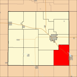 Location in Floyd County | |
| Coordinates: 42°57′58″N 92°37′05″W | |
| Country | |
| State | |
| County | Floyd |
| Area | |
| • Total | 44.35 sq mi (114.86 km2) |
| • Land | 44.19 sq mi (114.44 km2) |
| • Water | 0.16 sq mi (0.41 km2) 0.36% |
| Elevation | 1,037 ft (316 m) |
| Population (2000) | |
| • Total | 508 |
| • Density | 11.5/sq mi (4.4/km2) |
| Time zone | UTC-6 (CST) |
| • Summer (DST) | UTC-5 (CDT) |
| ZIP codes | 50616, 50636, 50658 |
| GNIS feature ID | 0468624 |
Geography
According to the United States Census Bureau, Riverton Township covers an area of 44.35 square miles (114.86 square kilometers); of this, 44.19 square miles (114.44 square kilometers, 99.63 percent) is land and 0.16 square miles (0.41 square kilometers, 0.36 percent) is water.
Cities, towns, villages
- Nashua (west quarter)
Unincorporated towns
- Carrville at 43.008863°N 92.574908°W
- Midway at 43.005251°N 92.605464°W
(This list is based on USGS data and may include former settlements.)
Adjacent townships
- Chickasaw Township, Chickasaw County (northeast)
- Bradford Township, Chickasaw County (east)
- Polk Township, Bremer County (southeast)
- Fremont Township, Butler County (south)
- Dayton Township, Butler County (southwest)
- Pleasant Grove Township (west)
- Saint Charles Township (northwest)
Cemeteries
The township contains these two cemeteries: Ligget and Riverton.
Major highways
Rivers
- Cedar River
Landmarks
- Bunns Woods County Park
- Howards Wood Recreational Area
School districts
- Charles City Community School District
- Greene Community School District
- Nashua-Plainfield Community School District
Political districts
- Iowa's 4th congressional district
- State House District 14
- State Senate District 7
gollark: Breadth first search? Just have a table of all the nearby waypoints provided by a server.
gollark: You basically just need a way to find positions (navigation upgrade, which is maths-free, or trilateration, which you can copypaste from CC's GPS) and pathfinding (easy).
gollark: What? Why?
gollark: Well, I *am* inevitable.
gollark: FINALLY someone doesn't accuse me of subliminal pizza advertising.
References
- United States Census Bureau 2008 TIGER/Line Shapefiles
- United States Board on Geographic Names (GNIS)
- United States National Atlas
- "U.S. Census website". Retrieved 2009-05-15.
External links
Places adjacent to Riverton Township, Floyd County, Iowa | |
|---|---|
Municipalities and communities of Floyd County, Iowa, United States | ||
|---|---|---|
| Cities | Map of Iowa highlighting Floyd County | |
| Townships | ||
| CDP | ||
| Other unincorporated communities | ||
| Footnotes | ‡This populated place also has portions in an adjacent county or counties | |
This article is issued from Wikipedia. The text is licensed under Creative Commons - Attribution - Sharealike. Additional terms may apply for the media files.