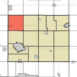
Polk Township, Bremer County, Iowa
Polk Township is one of fourteen townships in Bremer County, Iowa, USA. As of the 2010 census, its population was 922.[3]
Polk Township, Bremer County | |
|---|---|
 | |
| Coordinates: 42°51′35″N 092°29′36″W | |
| Country | |
| State | |
| County | Bremer |
| Area | |
| • Total | 36.75 sq mi (95.17 km2) |
| • Land | 36.73 sq mi (95.13 km2) |
| • Water | 0.02 sq mi (0.05 km2) |
| Elevation | 968 ft (295 m) |
| Population (2010) | |
| • Total | 922 |
| • Density | 25.1/sq mi (9.7/km2) |
| Time zone | UTC-6 (Central) |
| • Summer (DST) | UTC-5 (Central) |
| FIPS code | 19-93441[2] |
| GNIS feature ID | 0468555 |
Geography
Polk Township covers an area of 36.75 square miles (95.2 km2) and contains one incorporated settlement, Plainfield. The hamlet of Horton is situated southeast of the intersection of 140th Street (State Route 188) and Easton Avenue. According to the USGS, Polk Township contains three cemeteries: Horton, Jackson and Willow Lawn.
gollark: Well, you can get one by visiting the site for an hour cumulatively.
gollark: What do you have so far?
gollark: That would be a spoiler. No.
gollark: What, all of them?
gollark: Also, the infipage has been upgraded: https://osmarks.tk/infipage/p
References
- "US Board on Geographic Names". United States Geological Survey. 2007-10-25. Retrieved 2008-01-31.
- "U.S. Census website". United States Census Bureau. Retrieved 2008-01-31.
- "IA - Polk township". United States Census Bureau. Archived from the original on April 9, 2013. Retrieved March 17, 2013.
External links
Municipalities and communities of Bremer County, Iowa, United States | ||
|---|---|---|
| Cities | Map of Iowa highlighting Bremer County | |
| Townships | ||
| Unincorporated communities |
| |
| Footnotes | ‡This populated place also has portions in an adjacent county or counties | |
This article is issued from Wikipedia. The text is licensed under Creative Commons - Attribution - Sharealike. Additional terms may apply for the media files.