River Oaks, California
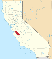
River Oaks is an unincorporated community in San Benito County, California, United States. River Oaks is located on the south bank of the Pajaro River and California State Route 129, 4.5 miles (7.2 km) northwest of San Juan Bautista.[2]
River Oaks, California | |
|---|---|
 River Oaks, California | |
| Coordinates: 36°53′59″N 121°35′40″W | |
| Country | United States |
| State | California |
| County | San Benito |
| Elevation | 141 ft (43 m) |
| Time zone | UTC-8 (Pacific (PST)) |
| • Summer (DST) | UTC-7 (PDT) |
| Area code(s) | 831 |
| GNIS feature ID | 1656258[1] |
Climate
This region experiences warm (but not hot) and dry summers, with no average monthly temperatures above 71.6 °F. According to the Köppen Climate Classification system, River Oaks has a warm-summer Mediterranean climate, abbreviated "Csb" on climate maps.[3]
gollark: well then learn.
gollark: That communicates, probably, with the bank's online API, which then likely runs over some weird internal network.
gollark: Good suggestion.
gollark: It's probably a weird horrific mess.
gollark: ```1. I need a banking system!while true do 2. Nobody is giving me full code samples! The documentation is too hard! 3. Krist is too hard to use! I'll make my own, that should be simpler. 4. Nobody is giving me full code samples for this *harder* project! 5. Hmm, they're telling me to use krist, let's try that again.end[between all steps] STOP MOCKING ME!```
References
- U.S. Geological Survey Geographic Names Information System: River Oaks, California
- Durham, David L. (1998). California's Geographic Names: A Gazetteer of Historic and Modern Names of the State. Quill Driver Books. p. 946. ISBN 1-884995-14-4.
- Climate Summary for River Oaks, California
This article is issued from Wikipedia. The text is licensed under Creative Commons - Attribution - Sharealike. Additional terms may apply for the media files.
