Rippee, Missouri
Rippee is an historic town in south central Douglas County, Missouri, United States.[1] The Rippee townsite was located on the northwest side of the Bryant Creek floodplain, due east of the confluence of Rippee Creek, which joins the Bryant from the west.[2] The site lies at an elevation of 784 ft (239 m)[1] and approximately 1.25 mi (2.01 km) south of the Missouri Route 14 bridge over the Bryant. The location is currently within the Rippee State Wildlife Management Area overseen by the Missouri Department of Conservation.[3]
Rippee, Missouri | |
|---|---|
Historic community | |
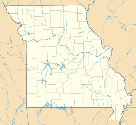 Rippee, Missouri Location of Rippee, Missouri | |
| Coordinates: 36°52′12″N 92°27′57″W[1] | |
| Country | U. S. A. |
| State | Missouri |
| County | Douglas County |
| Elevation | 239 m (784 ft) |
| Time zone | UTC-6 (CST) |
| • Summer (DST) | UTC-5 (CDT) |
A post office called Rippee was established in 1892, and remained in operation until 1936.[4] The community has the name of the local Rippee family.[5]
References
- U.S. Geological Survey Geographic Names Information System: Rippee (historical)
- Missouri Buckhart 15 Topographic Minute Quadrangle, USGS, 1945
- Rockbridge 7.5 Minute Topographic Quadrangle, 1973, USGS
- "Post Offices". Jim Forte Postal History. Retrieved 28 September 2016.
- "Douglas County Place Names, 1928–1945 (archived)". The State Historical Society of Missouri. Archived from the original on 24 June 2016. Retrieved 28 September 2016.CS1 maint: BOT: original-url status unknown (link)
Municipalities and communities of Douglas County, Missouri, United States | ||
|---|---|---|
| City | 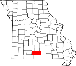 Map of Missouri highlighting Douglas County | |
| Townships |
| |
| Unincorporated communities |
| |
| Ghost towns | ||
This article is issued from Wikipedia. The text is licensed under Creative Commons - Attribution - Sharealike. Additional terms may apply for the media files.