Reeve Township, Daviess County, Indiana
Reeve Township is one of ten townships in Daviess County, Indiana. As of the 2010 census, its population was 631 and it contained 257 housing units.[3]
Reeve Township | |
|---|---|
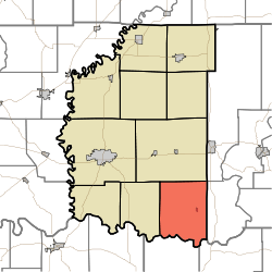 Location of Reeve Township in Daviess County | |
| Coordinates: 38°33′47″N 86°58′32″W | |
| Country | United States |
| State | Indiana |
| County | Daviess |
| Government | |
| • Type | Indiana township |
| Area | |
| • Total | 44.95 sq mi (116.4 km2) |
| • Land | 43.88 sq mi (113.6 km2) |
| • Water | 1.06 sq mi (2.7 km2) |
| Elevation | 512 ft (156 m) |
| Population (2010) | |
| • Total | 631 |
| • Density | 14.4/sq mi (5.6/km2) |
| FIPS code | 18-63702[2] |
| GNIS feature ID | 453785 |
History
Reeve Township was organized on 12 May 1817 at the first meeting of the Daviess County Commissioners. It was named for its earliest resident, South Carolina native Joshua Reeve, who had settled in the township in 1808. As the first settler in the area, Reeve lived in an isolated cabin in the forest; in order to obtain needed supplies, he was forced to travel to Vincennes. Desiring to simplify his travels, Reeve blazed a trail through the woods from his home to Vincennes; in later years, the route became a road, and by the early twentieth century it had become one of the county's leading highways.[4]
Geography
According to the 2010 census, the township has a total area of 44.95 square miles (116.4 km2), of which 43.88 square miles (113.6 km2) (or 97.62%) is land and 1.06 square miles (2.7 km2) (or 2.36%) is water.[3] Big Piney Pond and Little Piney Pond are in this township.
Cities and towns
Unincorporated towns
Adjacent townships
- Barr Township (north)
- Perry Township, Martin County (northeast)
- Rutherford Township, Martin County (east)
- Harbison Township, Dubois County (southeast)
- Boone Township, Dubois County (south)
- Harrison Township (west)
Cemeteries
The township contains three cemeteries: the Alfordsville Christian Cemetery just north of town, Old Union Cemetery on the land originally owned by James Allen and his wife, Mary Hizer Allen, southwest of town, and the Helpenstine Cemetery (also known as the McCord Cemetery) east of town on the County Line Road.
References
- "US Board on Geographic Names". United States Geological Survey. 2007-10-25. Retrieved 2008-01-31.
- "U.S. Census website". United States Census Bureau. Retrieved 2008-01-31.
- "Population, Housing Units, Area, and Density: 2010 - County -- County Subdivision and Place -- 2010 Census Summary File 1". United States Census. Archived from the original on 2020-02-12. Retrieved 2013-05-10.
- Fulkerson, A.O., ed. History of Daviess County Indiana: Its People, Industries, and Institutions. Bowen: Indianapolis, 1915, 274.
External links
Municipalities and communities of Daviess County, Indiana, United States | ||
|---|---|---|
| City | Map of Indiana highlighting Daviess County | |
| Towns | ||
| Townships | ||
| CDP | ||
| Other unincorporated communities | ||