Cornettsville, Indiana
Cornettsville is an unincorporated community in Bogard Township, Daviess County, Indiana.
Cornettsville | |
|---|---|
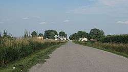
 Approaching Cornettsville from the west | |
 Cornettsville  Cornettsville | |
| Coordinates: 38°45′24″N 87°06′36″W | |
| Country | United States |
| State | Indiana |
| County | Daviess |
| Township | Bogard |
| Elevation | 495 ft (151 m) |
| ZIP code | 47568 |
| FIPS code | 18-15148[1] |
| GNIS feature ID | 432986[2] |
History
Cornettsville was laid out in 1875.[3] It was named for one of its founders, Samuel Cornett.[4] A post office was established at Cornettsville in 1878, and remained in operation until it was discontinued in 1902.[5]
The town's name was to be decided by which family was the largest in number at that time. The Cornett family and Myers families were the largest. The Cornetts won by one person.

Photo from Small Town Indiana photo survey.
Geography
Cornettsville is located at 38°45′24″N 87°06′36″W.
gollark: https://media.discordapp.net/attachments/477912057560432680/766996309067431966/image0.jpg?width=585&height=422
gollark: If the fireballs actually caused explod™, everything nearby would be devastated, so we should probably not have that‽
gollark: It turns out that - who would have guessed? - the fireballs actually propel the orbital laser strike target designator upward.
gollark: Due to orbital laser strike bugs it is now raining fire.
gollark: Blame cyan.
References
- "U.S. Census website". United States Census Bureau. Retrieved 2008-01-31.
- "Cornettsville, Indiana". Geographic Names Information System. United States Geological Survey. Retrieved 2009-10-10.
- History of Knox and Daviess County, Indiana: From the Earliest Time to the Present. Goodspeed. 1886. pp. 706.
- Gannett, Henry (1905). The Origin of Certain Place Names in the United States. Govt. Print. Off. pp. 92.
- "Daviess County". Jim Forte Postal History. Retrieved 31 August 2014.
This article is issued from Wikipedia. The text is licensed under Creative Commons - Attribution - Sharealike. Additional terms may apply for the media files.