Razgrad Municipality
Razgrad Municipality (Bulgarian: Община Разград) is a municipality (obshtina) in Razgrad Province, Northeastern Bulgaria, located in the Ludogorie geographical region part of the Danubian Plain. It is named after its administrative centre - the city of Razgrad which is also the capital of the province.
Razgrad Municipality Община Разград | |
|---|---|
Municipality | |
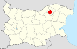 Razgrad Municipality within Bulgaria and Razgrad Province. | |
| Coordinates: 43°32′N 26°30′E | |
| Country | |
| Province (Oblast) | Razgrad |
| Admin. centre (Obshtinski tsentar) | Razgrad |
| Area | |
| • Total | 620 km2 (240 sq mi) |
| Population (December 2009)[1] | |
| • Total | 54,720 |
| • Density | 88/km2 (230/sq mi) |
| Time zone | UTC+2 (EET) |
| • Summer (DST) | UTC+3 (EEST) |
The municipality embraces a territory of 620 km² with a population of 54,720 inhabitants, as of December 2009.[1]
The main road E70 crosses the area, connecting the main town with the city of Ruse and the Danube Bridge.
Settlements
.png)
Kubrat
Isperih
Zavet
Loznitsa
Tsar Kaloyan
Samuil
Razgrad Municipality within Razgrad Province
Razgrad Municipality includes the following 22 places (towns are shown in bold):
| Town/Village | Cyrillic | Population[2][3][4] (December 2009) |
|---|---|---|
| Razgrad | Разград | 34,592 |
| Balkanski | Балкански | 322 |
| Blagoevo | Благоево | 640 |
| Cherkovna | Черковна | 148 |
| Dryanovets | Дряновец | 811 |
| Dyankovo | Дянково | 2,913 |
| Getsovo | Гецово | 1,902 |
| Kichenitsa | Киченица | 923 |
| Lipnik | Липник | 584 |
| Mortagonovo | Мортагоново | 1,091 |
| Nedoklan | Недоклан | 212 |
| Osenets | Осенец | 1,081 |
| Ostrovche | Островче | 164 |
| Pobit Kamak | Побит камък | 312 |
| Prostorno | Просторно | 189 |
| Poroishte | Пороище | 505 |
| Radingrad | Радинград | 306 |
| Rakovski | Раковски | 2,568 |
| Strazhets | Стражец | 1,957 |
| Topchii | Топчии | 568 |
| Ushintsi | Ушинци | 264 |
| Yasenovets | Ясеновец | 2,668 |
| Total | 54,720 |
Demography
The following table shows the change of the population during the last four decades.
| Razgrad Municipality | ||||||||
|---|---|---|---|---|---|---|---|---|
| Year | 1975 | 1985 | 1992 | 2001 | 2005 | 2007 | 2009 | 2011 |
| Population | 64,930 | 98,547 | 61,815 | 58,874 | 56,795 | 55,689 | 54,720 | ... |
| Sources: Census 2001,[5] Census 2011,[6] „pop-stat.mashke.org“,[7] | ||||||||
gollark: osmarks.net has had an uptime of 502 Bad Gatewaynginx/1.14.2 this week.
gollark: Basically, if we can make all the GEORGEnet or whatever servers agree on which subset are up and operating and what data they have, we can make them set the DNS records to point to only that subset.
gollark: We could avoid single point of failure via some ridiculously convoluted consensus algorithm and DNS meddling.
gollark: I disagree, we should arbitrarily reinvent all our software repeatedly.
gollark: Our various webrings should use diverse platforms to prevent horrendous beeizing due to compromises/bugs in one of them.
References
- (in English) Bulgarian National Statistical Institute - Bulgarian provinces and municipalities in 2009
- (in English) Bulgarian National Statistical Institute - Bulgarian towns in 2009
- (in English) Bulgarian National Statistical Institute - Bulgarian villages under 1000 inhabitants - December 2009
- (in English) Bulgarian National Statistical Institute - Bulgarian Settlements 1000-5000 inhabitants - December 2009
- (in English)National Statistical Institute - Census 2001
- „pop-stat.mashke.org“
- "Population of Bulgarian divisions". Pop-stat.mashke.org. 2011-02-01. Retrieved 2012-03-28.
External links
- Official website (in English)
Places adjacent to Razgrad Municipality | |
|---|---|
This article is issued from Wikipedia. The text is licensed under Creative Commons - Attribution - Sharealike. Additional terms may apply for the media files.