Ravid
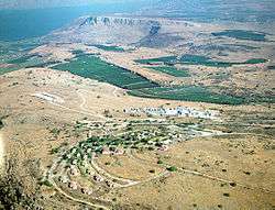
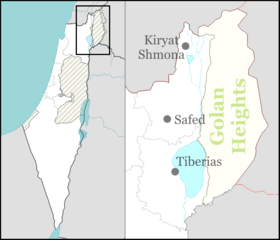
Ravid (Hebrew: רָבִיד, lit. "Necklace") is a small kibbutz in northern Israel. Located to the west of the Sea of Galilee, it falls under the jurisdiction of Emek HaYarden Regional Council. In 2019 it had a population of 114.[1]
Ravid | |
|---|---|
 Kibbutz Ravid and Mount Arbel | |
 Ravid | |
| Coordinates: 32°51′2.16″N 35°27′45.71″E | |
| Country | Israel |
| District | Northern |
| Council | Emek HaYarden |
| Affiliation | Kibbutz Movement |
| Founded | 1981 |
| Founded by | Demobbed Nahal soldiers |
| Population (2019)[1] | 114 |
History
Ravid was established in 1981 by members of the Takam movement as part of the Galilee lookouts programme, including 10 families who had moved from cities.[2] The site was land that had belonged to the depopulated Palestinian village of al-Mansura until the 1948 Arab–Israeli War, southeast of the village site.[3]
However, after a social crisis, the kibbutz was dismantled.[2][4] It was successfully re-established in 1994 by former members of HaNoar HaOved VeHaLomed, and is now part of the Dror-Israel movement.[2]
gollark: We're working with <@509849474647064576> and some other people.
gollark: Project PREDESTINED SPECTRE, as I said.
gollark: Oh, we do.
gollark: BAIDICOOT, UNAPPLY THIS!
gollark: CEASE!
References
- "Population in the Localities 2019" (XLS). Israel Central Bureau of Statistics. Retrieved 16 August 2020.
- "רביד" [Ravid] (in Hebrew). Tnuat Or. Retrieved April 18, 2019.
- Khalidi, W. (1992). All That Remains: The Palestinian Villages Occupied and Depopulated by Israel in 1948. Washington D.C.: Institute for Palestine Studies. p. 533. ISBN 0-88728-224-5.
- Rahat, Menachem (June 30, 1986). "'קיבוץ רביד בגליל 'ירד מן המפה" [Kibbutz Ravid in the Galilee 'fell off the map']. Maariv (in Hebrew). Retrieved April 18, 2019.
This article is issued from Wikipedia. The text is licensed under Creative Commons - Attribution - Sharealike. Additional terms may apply for the media files.