Rangapara, Kalna
Rangapara is a village in Kalna I CD block in Kalna subdivision of Purba Bardhaman district in the state of West Bengal, India.
Rangapara | |
|---|---|
Village | |
 Rangapara Location in West Bengal, India  Rangapara Rangapara (India) | |
| Coordinates: 23°13′55.0″N 88°20′27.0″E | |
| Country | |
| State | West Bengal |
| District | Purba Bardhaman |
| Population (2011) | |
| • Total | 3,435 |
| Languages | |
| • Official | Bengali, English |
| Time zone | UTC+5:30 (IST) |
| PIN | 713409 (Kalna) |
| Telephone/STD code | 03454 |
| Lok Sabha constituency | Bardhaman Purba |
| Vidhan Sabha constituency | Kalna |
| Website | bardhaman |
Geography
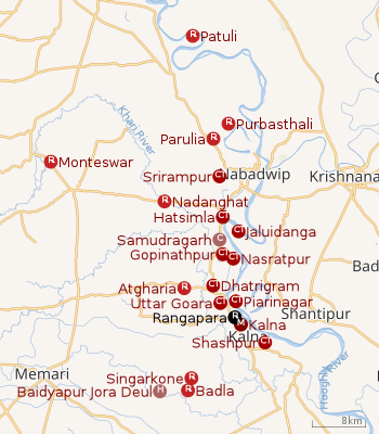 |
| Cities and towns in the Kalna subdivision of Purba Bardhaman district M: municipal city/ town, CT: census town, R: rural/ urban centre, H: historical/ religious cetre, C: craft centre. Owing to space constraints in the small map, the actual locations in a larger map may vary slightly |
Urbanisation
87.00% of the population of Kalna subdivision live in the rural areas. Only 13.00% of the population live in the urban areas.[3]The map alongside presents some of the notable locations in the subdivision. All places marked in the map are linked in the larger full screen map.
Demographics
As per the 2011 Census of India Rangapara had a total population of 3,435, of which 1,747 (51%) were males and 1,688 (49%) were females. Population below 6 years was 272. The total number of literates in Rangapara was 2,644 (83.59% of the population over 6 years).[4]
Transport
The State Highway 6 (West Bengal), running from Rajnagar (in Birbhum district) to Alampur (in Howrah district), passes through Rangapara.[5]
References
- "District Census Handbook: Barddhaman" (PDF). Map of Barddhaman with CD Block HQs and Police Stations (on the fourth page). Directorate of Census Operations, West Bengal, 2011. Retrieved 26 February 2017.
- "BDO Offices under Burdwan District". Department of Mass Education Extension & Library Services, Government of West Bengal. West Bengal Public Library Network. Retrieved 8 February 2019.
- "District Statistical Handbook 2014 Bardhaman". Table 2.2. Department of Statistics and Programme Implementation, Government of West Bengal. Retrieved 25 January 2019.
- "2011 Census – Primary Census Abstract Data Tables". West Bengal – District-wise. Registrar General and Census Commissioner, India. Retrieved 28 February 2017.
- "List of State Highways in West Bengal". West Bengal Traffic Police. Retrieved 1 March 2017.
Cities, towns and locations in Purba Bardhaman district, West Bengal | |||||||||
|---|---|---|---|---|---|---|---|---|---|
| Cities, municipal and census towns |
| ||||||||
| Locations other than cities and towns |
| ||||||||
| Related topics |
| ||||||||