Ramayampet
Ramayampet is a town and mandal and Municipality and Ramayampet Assembly Constancy 1952 to 2009 in Medak district in Indian state of Telangana.[1] It is the 4th biggest town in Medak district and is 80 km (50 mi) from Hyderabad.[2]
Ramayampet | |
|---|---|
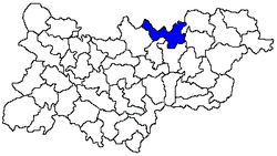 Location of the Ramayampet mandal in the Medak district | |
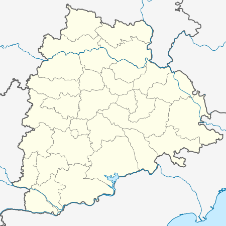 Ramayampet Location in Telangana, India  Ramayampet Ramayampet (India) | |
| Coordinates: 18.116609°N 78.429766°E | |
| Country | |
| State | Telangana |
| District | Medak |
| Population (2011) | |
| • Total | 16,899 |
| Languages | |
| • Official | Telugu |
| Time zone | UTC+5:30 (IST) |
| Vehicle registration | TS |
| Literacy | 70.93% |
| Website | medak |
Geography
Ramayampet is located at 18.116609°N 78.429766°E.[3] It has an average elevation of 475 m (1,558 ft). Ramayampet is centrally located between Hyderabad and Nizamabad also between Siddipet and Sangareddy. It has got both National highway, state highway and rail transport system is just 4 kms away from the town.
Demographics
As of 2011 India census, Ramayampet had a population of 16899. Males constitute 49.16% of the population and females 50.84%. Ramayampet has an average literacy rate of 70.93%, lower than the national average of 74.04%: male literacy is 81.79% and female literacy is 60.45%. Ramayampet became municipality in 2018 and 12 wards were made.[2]
References
- "District Level Mandal wise list of villages in Medak district" (PDF). Chief Commissioner of Land Administration. National Informatics Centre. Archived from the original (PDF) on 2 April 2015. Retrieved 5 March 2016.
- "List of towns: Census of India 2001" (PDF). www.censusindia.gov.in. Retrieved 24 September 2007.
- Falling Rain Genomics, Inc - Ramayampet