Raihion
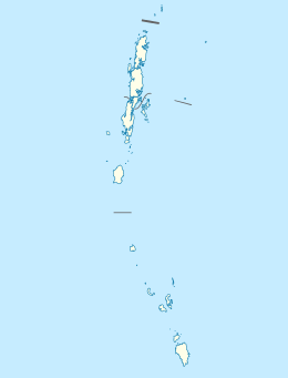
Raihion is a village in the Nicobar district of Andaman and Nicobar Islands, India.[1] It is located in the Nancowry tehsil on the Chowra (a.k.a. Sanenyo) island.
Raihion | |
|---|---|
village | |
 Raihion Location in Andaman and Nicobar Islands, India  Raihion Raihion (India) | |
| Coordinates: 8.455052°N 93.045210°E | |
| Country | India |
| State | Andaman and Nicobar Islands |
| District | Nicobar |
| Tehsil | Nancowry |
| Population (2011) | |
| • Total | 276 |
| Time zone | UTC+5:30 (IST) |
| Census code | 645032 |
Demographics
According to the 2011 census of India, Raihion has 74 households. The effective literacy rate (i.e. the literacy rate of population excluding children aged 6 and below) is 46.12%.[2]
| Total | Male | Female | |
|---|---|---|---|
| Population | 276 | 150 | 126 |
| Children aged below 6 years | 44 | 29 | 15 |
| Scheduled caste | 0 | 0 | 0 |
| Scheduled tribe | 263 | 138 | 125 |
| Literates | 107 | 65 | 42 |
| Workers (all) | 61 | 61 | 0 |
| Main workers (total) | 17 | 17 | 0 |
| Main workers: Cultivators | 0 | 0 | 0 |
| Main workers: Agricultural labourers | 0 | 0 | 0 |
| Main workers: Household industry workers | 0 | 0 | 0 |
| Main workers: Other | 17 | 17 | 0 |
| Marginal workers (total) | 44 | 44 | 0 |
| Marginal workers: Cultivators | 0 | 0 | 0 |
| Marginal workers: Agricultural labourers | 0 | 0 | 0 |
| Marginal workers: Household industry workers | 0 | 0 | 0 |
| Marginal workers: Others | 44 | 44 | 0 |
| Non-workers | 215 | 89 | 126 |
gollark: textutils.prompt comes with *no* backdoors in potatoS!
gollark: <@!184468521042968577> PotatOS now has textutils.prompt.
gollark: Also bad.
gollark: Also the horrible dan200 formatting generally.
gollark: It's where you name variables `bWhatever`, i.e. type of variable then actual name.
References
- "Andaman and Nicobar Islands villages" (PDF). Land Records Information Systems Division, NIC. Retrieved 25 July 2015.
- "District Census Handbook - Andaman & Nicobar Islands" (PDF). 2011 Census of India. Directorate of Census Operations, Andaman & Nicobar Islands. Retrieved 21 July 2015.
This article is issued from Wikipedia. The text is licensed under Creative Commons - Attribution - Sharealike. Additional terms may apply for the media files.