Ragsdale, Indiana
Ragsdale is an unincorporated community and census-designated place in Washington Township, Knox County, Indiana. As of the 2010 census it had a population of 129.[3]
Ragsdale, Indiana | |
|---|---|
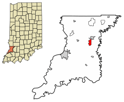 Location in Knox County, Indiana | |
 Ragsdale Location in Knox County, Indiana  Ragsdale Ragsdale (the United States) | |
| Coordinates: 38°44′45″N 87°19′30″W | |
| Country | United States |
| State | Indiana |
| County | Knox |
| Township | Washington |
| Area | |
| • Total | 2.23 sq mi (5.77 km2) |
| • Land | 2.23 sq mi (5.77 km2) |
| • Water | 0.0 sq mi (0.0 km2) |
| Elevation | 564 ft (172 m) |
| Population (2010) | |
| • Total | 129 |
| • Density | 58/sq mi (22.4/km2) |
| ZIP code | 47573 |
| FIPS code | 18-62730[2] |
| GNIS feature ID | 441730 |
Geography
Ragsdale is located in eastern Knox County at 38°44′45″N 87°19′30″W. It is 13 miles (21 km) northeast of Vincennes, the county seat, and the same distance northwest of Washington.
According to the U.S. Census Bureau, the Ragsdale CDP has an area of 2.2 square miles (5.8 km2), all of it land.[3]
Demographics
| Historical population | |||
|---|---|---|---|
| Census | Pop. | %± | |
| U.S. Decennial Census[4] | |||
gollark: That is such an intersecting chord.
gollark: Sure, you hyperbolic sine.
gollark: Can we get programming language logo emojons? <@319753218592866315> <@175456582098878464>
gollark: O🐪
gollark: This is called see_no_evil - yes, really.
References
- "US Board on Geographic Names". United States Geological Survey. 2007-10-25. Retrieved 2008-01-31.
- "U.S. Census website". United States Census Bureau. Retrieved 2008-01-31.
- "Geographic Identifiers: 2010 Demographic Profile Data (G001): Ragsdale CDP, Indiana". American Factfinder. U.S. Census Bureau. Retrieved February 26, 2019.
- "Census of Population and Housing". Census.gov. Retrieved June 4, 2016.
Municipalities and communities of Knox County, Indiana, United States | ||
|---|---|---|
| Cities | Map of Indiana highlighting Knox County | |
| Towns | ||
| Townships | ||
| CDPs | ||
| Other unincorporated communities | ||
This article is issued from Wikipedia. The text is licensed under Creative Commons - Attribution - Sharealike. Additional terms may apply for the media files.