Rader, Missouri
Rader is an unincorporated community in the northeast corner of Webster County, in the Ozarks of southwest Missouri.[1] The community is located on Missouri Route ZZ between Conway to the northwest and Grovespring to the southeast. Rader is on the southern floodplain of the Osage Fork Gasconade River.[2][3]
History
A post office called Rader was established in 1886, and remained in operation until 1905.[4] The community has the name of the local Rader family.[5]
gollark: \™
gollark: AMD EPYC\t
gollark: I have many things
gollark: It used to say "Everything is okay", then "Everyone is gay" (except justyn), then "Everything is horrible" (coronavirus) or something, then "AAAAAAA EVERYTHING IS HORRIBLE", then... osteoporosis?
gollark: https://pastebin.com/SPyr8jrh
References
- U.S. Geological Survey Geographic Names Information System: Rader, Missouri
- Missouri Atlas & Gazetteer, DeLorme, 1998, First edition, p. 53, ISBN 0-89933-224-2
- Radar Missouri 7.5 Minute Topographic Quadrangle, USGS, 1956
- "Post Offices". Jim Forte Postal History. Retrieved 1 January 2017.
- "Webster County Place Names, 1928–1945". The State Historical Society of Missouri. Archived from the original on June 24, 2016. Retrieved January 2, 2017.
Municipalities and communities of Webster County, Missouri, United States | ||
|---|---|---|
| Cities | 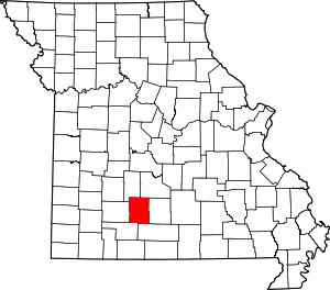 Map of Missouri highlighting Webster County | |
| Village | ||
| Townships |
| |
| Unincorporated communities | ||
| Ghost towns | ||
| Footnotes | ‡This populated place also has portions in an adjacent county or counties | |
This article is issued from Wikipedia. The text is licensed under Creative Commons - Attribution - Sharealike. Additional terms may apply for the media files.