Punta Sardina Lighthouse
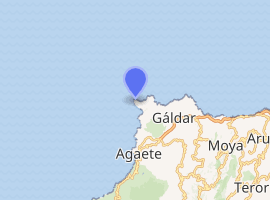
The Punta Sardina Lighthouse (Spanish: Faro de Punta Sardina) is an active lighthouse on the Canary island of Gran Canaria. It is located north of the small town of Sardina, in the municipality of Gáldar.[2] The Punta Sardina light marks the north-western extremity of the island, and lies between the Punta del Castillete lighthouse near Puerto de Mogán to the south and the La Isleta lighthouse of Las Palmas to the east.[3]
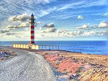
 The lighthouse in 2006 | |
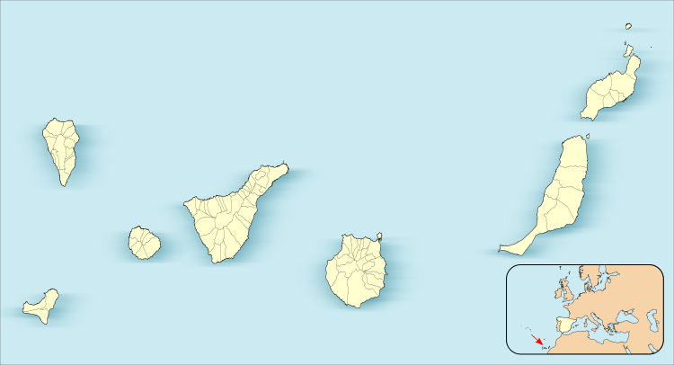
 Canary Islands | |

| |
| Location | Gáldar Gran Canaria Canary Islands Spain |
|---|---|
| Coordinates | 28.164712°N 15.707848°W |
| Year first constructed | 1891 (first) |
| Year first lit | 1985 (current) |
| Construction | masonry tower |
| Tower shape | cylindrical tower with double balcony and lantern |
| Markings / pattern | tower with red and white bands, grey metallic lantern dome |
| Tower height | 24 metres (79 ft) |
| Focal height | 47 metres (154 ft) |
| Light source | mains power |
| Range | 20 nautical miles (37 km; 23 mi) |
| Characteristic | Fl (4) W 20s. |
| Admiralty number | D2816 |
| NGA number | 23928 |
| ARLHS number | CAI-055 |
| Spain number | ES-12610 |
| Managing agent | Autoridad Portuaria de Las Palmas de Gran Canaria[1] |
History
The lighthouse is the second to be constructed on the rocky headland of Punta Sardina (Sardine Point), which overlooks the Atlantic Ocean. The first was completed in 1891, as part of the first maritime lighting plan for the Canaries. It remained in service until it was demolished in the 1980s to make way for the new modern tower.[4]
The new light first entered service in 1985, and consists of a 24 metres (79 ft) high cylinder-shaped tower, which is white with four red bands. It supports twin galleries and a lantern with a grey cupola.[2] With a focal height of 47 metres (154 ft) above sea level, the light can be seen for 20 nautical miles. Its light characteristic is made up of four flashes of white light every twenty seconds.[2][5][6]
The lighthouse is maintained by the Port authority of the Province of Las Palmas. It is registered under the international Admiralty number D2816 and has the NGA identifier of 113-23928.[2]
References
- Punta Sardina Archived 4 March 2016 at the Wayback Machine The Lighthouse Directory. University of North Carolina at Chapel Hill. Retrieved 29 March 2016
- Rowlett, Russ. "Lighthouses of Spain: Canary Islands". The Lighthouse Directory. University of North Carolina at Chapel Hill. Retrieved 20 May 2015.
- Griffes; National Geospatial-Intelligence Agency (1 October 2009). NGA Sailing Directions-Enroute: 2008 West Coast of Europe and Northwest Africa (11th Edition). ProStar Publications. p. 172. ISBN 978-1-57785-885-0.
- "Los faros que alumbran et Atlantico" (in Spanish). teldeactualidad.com. Archived from the original on 8 August 2017. Retrieved 2 May 2015.
- List of Lights, Pub. 113: The West Coasts of Europe and Africa, the Mediterranean Sea, Black Sea and Azovskoye More (Sea of Azov) (PDF). List of Lights. United States National Geospatial-Intelligence Agency. 2013. p. 418.
- "2816 Faro de Punta Sardina". Faros Canarias (in Spanish). Guias masmar. Archived from the original on 4 March 2016. Retrieved 7 June 2015.
External links
| Wikimedia Commons has media related to Punta Sardina Lighthouse. |
_-_OSM_Mapnik.svg.png)
