Puerto Lumbreras
Puerto Lumbreras (Spanish: [ˈpweɾto lumˈbɾeɾas]) is a Spanish municipality in the autonomous community of Murcia. It has a population of 14,981 (2018) and an area of 139 km² .
Puerto Lumbreras | |
|---|---|
Municipality | |
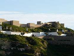
 Castle of Nogalte | |
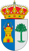
 Coat of arms | |
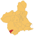
 Puerto Lumbreras Location in Spain | |
| Coordinates: 37°33′48″N 1°48′26″W | |
| Country | |
| Autonomous Community | |
| Province | Region of Murcia |
| Comarca | Alto Guadalentín |
| Government | |
| • Mayor | María Ángeles Túnez García (PP) |
| Area | |
| • Total | 338 km2 (131 sq mi) |
| Elevation (AMSL) | 465 m (1,526 ft) |
| Population (2018)[1] | |
| • Total | 14,981 |
| • Density | 44/km2 (110/sq mi) |
| Time zone | UTC+1 (CET) |
| • Summer (DST) | UTC+2 (CEST (GMT +2)) |
| Postal code | 30890 |
| Area code(s) | +34 (Spain) + 968 (Murcia) |
| Website | www |
Gallery
 Location of Puerto Lumbreras.
- Puerto Lumbreras City Office in Doctor Salvador Caballeo Garcia area
 Picture show by flood damage in Puerto Lumreras on October, 1973
gollark: Nesting the same sandbox is totally unhelpful.
gollark: <@151391317740486657> Not really.
gollark: The protections are just to buy some time and prevent accidentally running it.
gollark: NOTHING would be properly secure against dangerous unfriendly AI or something.
gollark: That would NOT BE SECURE.
References
- Municipal Register of Spain 2018. National Statistics Institute.
External links
- Ayuntamiento de Puerto Lumbreras (in Spanish)
- Business guide and General Information in English and Spanish (in English)
This article is issued from Wikipedia. The text is licensed under Creative Commons - Attribution - Sharealike. Additional terms may apply for the media files.