Calasparra
Calasparra (Spanish: [kalasˈpara]) is a municipality in the autonomous community of Murcia, Spain. It shares borders with Cieza, Mula, Cehegín, Moratalla and province of Albacete.[4]
Calasparra | |
|---|---|
 | |
 Flag .svg.png) Coat of arms | |
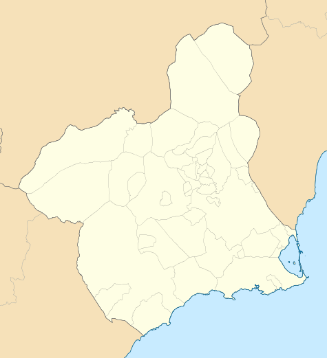
 Calasparra Location in Spain  Calasparra Calasparra (Spain) | |
| Coordinates: 38°13′50″N 1°42′00″W | |
| Country | |
| Autonomous community | |
| Province | Province of Murcia |
| Comarca | Noroeste |
| • Mayor | (PSOE[1]) |
| Area | |
| • Total | 184.9 km2 (71.4 sq mi) |
| Elevation | 338 m (1,109 ft) |
| Population (10,178)[2] | |
| • Total | 10,178 |
| • Density | 55/km2 (140/sq mi) |
| Time zone | UTC+1 (CET) |
| • Summer (DST) | UTC+2 (CEST) |
| Postal code | 30420[3] |
| Dialing code | (+34) 968 |
| Website | www |
Geography
Calasparra has an area of 193 km² and a population of 10,178 (2019).[5][6]. Between 2004 and 2006 more than 2,000 British immigrants bought new homes off-plan, built on 3 new urbanisations surrounding the town, with more purchasing country homes.
Calasparra is situated in a mountainous region (398m) in the northwest of the province of Murcia. In contrast to the surrounding arid terrain, Calasparra benefits from being crossed by four rivers, including the Segura. This has enabled the cultivation of Calasparra rice, for which the town is noted, and dates back to the 14th century.
The population is predominantly Spanish, but other nationalities can be found here, particularly Moroccans and English.
Economy
62.3% of the surface of the municipality is used for landcrops purposes.[7] The products that are more widely grown are apricots, almonds, peaches and olives.[8] 33,54% of the agreements that were signed in 2018 corresponded to the agricultural sector and 47,16% corresponded to services sector.[9]
Main sights
There are some sites and buildings that have special historic values:[10]
- Villa Vieja: It is an archeological site that was anciently a settlement of the Muslim Iberian Peninsula era.
- Calasparra's Castle: It was probably built in the 11th century, during the Muslim Iberian Peninsula era. It was abandoned after a Mudejar revolt in 1264, once that the territory had been conquered by Castile. The king of Castile Sancho Villa bestowed the castle and the town to a military religious order in 1289.
- Rambla de los Arcos Aqueduct
- El Molinico: It was built in the 16th century.
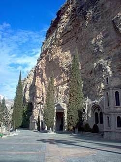
- Virgen de la Esperanza Shrine[11]
- Torre del Reloj (Clock Tower)
- La Encomienda: It was built in 1730 and 1731.
References
- https://www.carm.es/web/pagina?IDCONTENIDO=1455&IDTIPO=221&RASTRO=c475$m1647,1086,1078
- Municipal Register of Spain 2018. National Statistics Institute.
- https://www.correos.es/ss/Satellite/site/aplicacion-1349167812778-herramientas_y_apps/detalle_app-sidioma=es_ES
- https://www.researchgate.net/figure/Figura-1-Mapa-de-municipios-de-la-Region-de-Murcia_fig1_26442489
- https://ine.es/dyngs/INEbase/es/operacion.htm?c=Estadistica_C&cid=1254736177010&menu=resultados&idp=1254734710990
- https://econet.carm.es/web/crem/inicio/-/crem/sicrem/PU_CalasparraCifras/P8001/sec2.html
- "CREM - Datos Municipales Calasparra - 1. Evolución de la distribución general de la tierra" (in Spanish). Retrieved 2020-06-07.
- "CREM - Datos Municipales Calasparra - 3. Evolución de la superficie dedicada a cada grupo de cultivo" (in Spanish). Retrieved 2020-06-07.
- "CREM - Datos Municipales Calasparra - 3. Evolución de los contratos de trabajo registrados según sector de actividad económica. CNAE-2009" (in Spanish). Retrieved 2020-06-07.
- "Monumentos" (in Spanish). Retrieved 2020-06-07.
- Murcia, Instituto de Turismo de la Región de. "Santuario de la Virgen de la Esperanza : Official Murcia Region tourist site". murciaturistica.es. Retrieved 2020-06-07.
External links
- Official municipal government website of Calasparra (in Spanish)
- Viva Murcia community info/photos for Calasparra