Pudtol
Pudtol, officially the Municipality of Pudtol, (Ilocano: Ili ti Pudtol; Tagalog: Bayan ng Pudtol), is a 4th class municipality in the province of Apayao, Philippines. According to the 2015 census, it has a population of 14,925 people.[3]
Pudtol | |
|---|---|
| Municipality of Pudtol | |
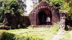
 Pudtol Church ruins | |
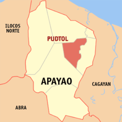
 Map of Apayao with Pudtol highlighted | |
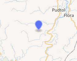
OpenStreetMap 
| |
.svg.png) Pudtol Location within the Philippines | |
| Coordinates: 18°09′N 121°17′E | |
| Country | |
| Region | Cordillera Administrative Region (CAR) |
| Province | Apayao |
| District | Lone District |
| Barangays | 22 (see Barangays) |
| Government | |
| • Type | Sangguniang Bayan |
| • Mayor | Hector Reuel D. Pascua |
| • Vice Mayor | Randy A. Laoat |
| • Congressman | Elias C. Bulut Jr. |
| • Electorate | 9,065 voters (2019) |
| Area | |
| • Total | 401.02 km2 (154.83 sq mi) |
| Population (2015 census)[3] | |
| • Total | 14,925 |
| • Density | 37/km2 (96/sq mi) |
| • Households | 3,158 |
| Economy | |
| • Income class | 4th municipal income class |
| • Poverty incidence | 26.41% (2015)[4] |
| • Revenue (₱) | 87,548,913.42 (2016) |
| Time zone | UTC+8 (PST) |
| ZIP code | 3812 |
| PSGC | |
| IDD : area code | +63 (0)74 |
| Climate type | tropical rainforest climate |
| Native languages | Atta language Isnag Ilocano Tagalog |
On June 22, 1963, several barrios and sitios were separated from Pudtol and constituted into the newly created municipality of Flora.[5]
Geography
According to the Philippine Statistics Authority, the municipality has a land area of 401.02 square kilometres (154.83 sq mi) [2] constituting 9.09% of the 4,413.35-square-kilometre- (1,704.00 sq mi) total area of Apayao.
Barangays
Pudtol is politically subdivided into 22 barangays.[6]
| PSGC | Barangay | Population | ±% p.a. | |||
|---|---|---|---|---|---|---|
| 2015[3] | 2010[7] | |||||
| 148106001 | Aga | 2.3% | 343 | 276 | 4.22% | |
| 148106002 | Alem | 5.7% | 855 | 875 | −0.44% | |
| 148106022 | Amado | 5.4% | 802 | 791 | 0.26% | |
| 148106023 | Aurora | 2.4% | 355 | 296 | 3.52% | |
| 148106006 | Cabatacan | 10.2% | 1,529 | 1,313 | 2.94% | |
| 148106007 | Cacalaggan | 3.4% | 513 | 405 | 4.60% | |
| 148106009 | Capannikian | 9.3% | 1,381 | 1,192 | 2.84% | |
| 148106024 | Doña Loreta | 4.9% | 737 | 711 | 0.69% | |
| 148106025 | Emilia | 3.6% | 537 | 427 | 4.46% | |
| 148106026 | Imelda | 4.2% | 621 | 552 | 2.27% | |
| 148106010 | Lower Maton | 2.5% | 369 | 345 | 1.29% | |
| 148106027 | Lt. Balag | 1.4% | 214 | 176 | 3.79% | |
| 148106028 | Lydia | 4.2% | 624 | 529 | 3.19% | |
| 148106012 | Malibang | 3.6% | 539 | 472 | 2.56% | |
| 148106014 | Mataguisi | 6.7% | 1,004 | 807 | 4.25% | |
| 148106016 | Poblacion | 6.1% | 911 | 836 | 1.65% | |
| 148106017 | San Antonio (Pugo) | 1.2% | 186 | 171 | 1.61% | |
| 148106029 | San Jose | 2.3% | 344 | 361 | −0.91% | |
| 148106030 | San Luis | 5.2% | 772 | 683 | 2.36% | |
| 148106031 | San Mariano | 2.5% | 377 | 463 | −3.84% | |
| 148106020 | Swan | 10.1% | 1,503 | 1,253 | 3.52% | |
| 148106021 | Upper Maton | 2.7% | 409 | 371 | 1.87% | |
| Total | 14,925 | 13,305 | 2.21% | |||
Climate
| Climate data for Pudtol, Apayao | |||||||||||||
|---|---|---|---|---|---|---|---|---|---|---|---|---|---|
| Month | Jan | Feb | Mar | Apr | May | Jun | Jul | Aug | Sep | Oct | Nov | Dec | Year |
| Average high °C (°F) | 25 (77) |
26 (79) |
28 (82) |
31 (88) |
31 (88) |
31 (88) |
30 (86) |
30 (86) |
30 (86) |
28 (82) |
27 (81) |
25 (77) |
29 (83) |
| Average low °C (°F) | 20 (68) |
20 (68) |
21 (70) |
22 (72) |
24 (75) |
25 (77) |
24 (75) |
24 (75) |
24 (75) |
23 (73) |
22 (72) |
21 (70) |
23 (73) |
| Average precipitation mm (inches) | 120 (4.7) |
77 (3.0) |
62 (2.4) |
40 (1.6) |
118 (4.6) |
138 (5.4) |
162 (6.4) |
173 (6.8) |
143 (5.6) |
198 (7.8) |
185 (7.3) |
248 (9.8) |
1,664 (65.4) |
| Average rainy days | 16.9 | 12.2 | 11.5 | 10.6 | 18.7 | 20.1 | 21.2 | 23.3 | 20.8 | 16.9 | 16.5 | 20.0 | 208.7 |
| Source: Meteoblue [8] | |||||||||||||
Demographics
| Year | Pop. | ±% p.a. |
|---|---|---|
| 1960 | 7,720 | — |
| 1970 | 5,735 | −2.93% |
| 1975 | 6,547 | +2.69% |
| 1980 | 7,598 | +3.02% |
| 1990 | 7,621 | +0.03% |
| 1995 | 8,656 | +2.41% |
| 2000 | 11,039 | +5.35% |
| 2007 | 12,595 | +1.84% |
| 2010 | 13,305 | +2.02% |
| 2015 | 14,925 | +2.21% |
| Source: Philippine Statistics Authority[3][7][9][10] | ||
In the 2015 census, Pudtol had a population of 14,925.[3] The population density was 37 inhabitants per square kilometre (96/sq mi).
References
- "Municipality". Quezon City, Philippines: Department of the Interior and Local Government. Retrieved 31 May 2013.
- "Province: Apayao". PSGC Interactive. Quezon City, Philippines: Philippine Statistics Authority. Retrieved 12 November 2016.
- Census of Population (2015). "Cordillera Administrative Region (CAR)". Total Population by Province, City, Municipality and Barangay. PSA. Retrieved 20 June 2016.
- "PSA releases the 2015 Municipal and City Level Poverty Estimates". Quezon City, Philippines. Retrieved 12 October 2019.
- "Republic Act No. 3672 - An Act Creating the Municipality of Flora in the Subprovince of Apayao, Mountain Province". Chan Robles Virtual Law Library. 22 June 1963. Archived from the original on 26 September 2013. Retrieved 4 November 2016.
- "Municipal: Pudtol". PSGC Interactive. Quezon City, Philippines: Philippine Statistics Authority. Retrieved 8 January 2016.
- Census of Population and Housing (2010). "Cordillera Administrative Region (CAR)". Total Population by Province, City, Municipality and Barangay. NSO. Retrieved 29 June 2016.
- "Pudtol: Average Temperatures and Rainfall". Meteoblue. Retrieved 8 March 2020.
- Censuses of Population (1903–2007). "Cordillera Administrative Region (CAR)". Table 1. Population Enumerated in Various Censuses by Province/Highly Urbanized City: 1903 to 2007. NSO.
- "Province of Apayao". Municipality Population Data. Local Water Utilities Administration Research Division. Retrieved 17 December 2016.