Pototan, Iloilo
Pototan, officially the Municipality of Pototan (Hiligaynon: Banwa sang Pototan, Tagalog: Bayan ng Pototan), is a 1st class municipality in the province of Iloilo, Philippines. According to the 2015 census, it has a population of 75,070 people.[3]
Pototan | |
|---|---|
| Municipality of Pototan | |
Municipal Hall | |
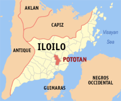
 Map of Iloilo with Pototan highlighted | |
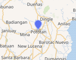
OpenStreetMap 
| |
.svg.png) Pototan Location within the Philippines | |
| Coordinates: 10°57′N 122°38′E | |
| Country | |
| Region | Western Visayas (Region VI) |
| Province | Iloilo |
| District | 3rd district of Iloilo |
| Founded | 1874 |
| Barangays | 50 (see Barangays) |
| Government | |
| • Type | Sangguniang Bayan |
| • Mayor | Rafael Enrique P. Lazaro |
| • Vice Mayor | Romualdo Joselito M. Ilisan |
| • Congressman | Lorenz R. Defensor |
| • Electorate | 43,265 voters (2019) |
| Area | |
| • Total | 97.10 km2 (37.49 sq mi) |
| Population (2015 census)[3] | |
| • Total | 75,070 |
| • Density | 770/km2 (2,000/sq mi) |
| • Households | 15,941 |
| Economy | |
| • Income class | 1st municipal income class |
| • Poverty incidence | 21.24% (2015)[4] |
| • Revenue (₱) | 157,882,222.82 (2016) |
| Time zone | UTC+8 (PST) |
| ZIP code | 5008 |
| PSGC | |
| IDD : area code | +63 (0)33 |
| Climate type | tropical climate |
| Native languages | Kinaray-a language Hiligaynon Tagalog |
| Website | www |
The town lies on the banks of the Suage River, 30 kilometres (19 mi) north from Iloilo City. The town has an area of 94 km², 85% of which is agricultural land. In December 1997, it was declared as the "Christmas Capital of Western Visayas" because of its famed Christmas Festival of Lights.
Considered the rice granary of Panay, the town is bordered by Dingle to the north, Zarraga to the south, Barotac Nuevo to the east, New Lucena, Iloilo and Mina to the west.
History
Early history
The first people of Pototan were the family of Datu Ramon, grandson of Datu Puti, a Malay from the town of Dumangas. They first settled at Barangay Naslo, which was formerly the poblacion (town center). In that place was found a luxuriant growth of trees called "putat", after which the place was subsequently called "Kaputatan" or "place of many Putat trees." However, due to its hilly terrain and poor water supply, they decided to move nearer the bank of the Suage River, now called Pototan.
In the middle of the 16th century, the Chinese traders arrived in Pototan.
Spanish era
The arrival of the Spaniards in 1593 sparked new changes in the socio-economic and political life of the natives. It was the start of a new era, the natives were converted to Catholicism through the efforts of Augustinian Friars. The settlement was subsequently made into a Parish. Education, though at the onset only for the privileged few, was introduced. The name "Kaputatan", which the Spanish have difficulty pronouncing, was changed to "Pototan".
The Spanish built roads and bridges. Don Tomas Sajen and Don Escribano supervised the construction of the Tribunal (municipal hall) with the natives contributing the labor. The Tribunal withstood World War II and in the early 50s was modified into what is now the Western Visayas Hospital.
In 1874, Pototanons began to run their own political affairs with the appointment of Don Juan Marcelo as the first Capitan Municipal. This form of government continued until the arrival of the Americans.
During the incumbency of Capitan Municipal Braulio Peñaranda in 1891, there was a cholera outbreak.
During the Philippine Revolution, Pototanons such as Teresa Magbanua (known as the Joan of arc of the Visayas[5]) and her two brothers, Elias and Pascual Magbanua took up arms and joined the revolution.
The Americans arrived after Spain ceded Philippines to the United States in 1898. The remaining Spanish population fled to the hills together with many Filipinos including the last Gobernadorcillio, Don Maurillo Mendoza. He was later held prisoner by the Americans but subsequently named the first Municipal President.
American era
Under the Americans, the natives were granted the freedom of speech and worship. Education was liberalized; more and better roads and bridges were constructed. Improvements were also noticed in the economic, social and cultural life of the people.
During the incumbency of Mun. President Maurillo Mendoza, the Pototanons again witnessed another unforgettable event: the burning of the entire half of the poblacion in November 1914. The cause of the fire is unknown.
When the Philippine Constitution was ratified in 1935, another change in the town's local governance was introduced: the title of Municipal President was changed to Municipal Mayor. Santiago Puig was the first Municipal Mayor. He was succeeded by Mariano Peñaflorida in 1940. Peñaflorida served until September 16, 1942.
World War II
The coming of the Japanese during World War II spread chaos and fear among Pototanons. Mayor Peñaflorida continued to act as Mayor under the Free Revolutionary Government of Tomas Confesor while the Japanese Imperial Forces designated Tomas Ferrariz as Puppet Mayor.
Barangays
Pototan is politically subdivided into 50 barangays. [2]
- Abangay
- Amamaros
- Bagacay
- Barasan
- Batuan
- Bongco
- Cahaguichican
- Callan
- Cansilayan
- Casalsagan
- Cato-ogan
- Cau-ayan
- Culob
- Danao
- Dapitan
- Dawis
- Dongsol
- Fundacion
- Guinacas
- Guibuangan
- Igang
- Intaluan
- Iwa Ilaud
- Iwa Ilaya
- Jamabalud
- Jebioc
- Lay-Ahan
- Primitivo Ledesma Ward (Pob.
- Lopez Jaena Ward (Poblacion)
- Lumbo
- Macatol
- Malusgod
- Naslo
- Nabitasan
- Naga
- Nanga
- Pajo
- Palanguia
- Fernando Parcon Ward (Poblacion)
- Pitogo
- Polot-an
- Purog
- Rumbang
- San Jose Ward (Poblacion)
- Sinuagan
- Tuburan
- Tumcon Ilaya
- Tumcon Ilaud
- Ubang
- Zarrague
Climate
| Climate data for Pototan, Iloilo | |||||||||||||
|---|---|---|---|---|---|---|---|---|---|---|---|---|---|
| Month | Jan | Feb | Mar | Apr | May | Jun | Jul | Aug | Sep | Oct | Nov | Dec | Year |
| Average high °C (°F) | 28 (82) |
29 (84) |
30 (86) |
32 (90) |
32 (90) |
30 (86) |
29 (84) |
29 (84) |
29 (84) |
29 (84) |
29 (84) |
28 (82) |
30 (85) |
| Average low °C (°F) | 23 (73) |
22 (72) |
23 (73) |
23 (73) |
25 (77) |
25 (77) |
24 (75) |
24 (75) |
24 (75) |
24 (75) |
24 (75) |
23 (73) |
24 (74) |
| Average precipitation mm (inches) | 57 (2.2) |
37 (1.5) |
41 (1.6) |
42 (1.7) |
98 (3.9) |
155 (6.1) |
187 (7.4) |
162 (6.4) |
179 (7.0) |
188 (7.4) |
114 (4.5) |
78 (3.1) |
1,338 (52.8) |
| Average rainy days | 12.0 | 7.7 | 9.2 | 10.2 | 19.5 | 24.6 | 26.9 | 25.1 | 25.5 | 25.2 | 18.0 | 13.0 | 216.9 |
| Source: Meteoblue [6] | |||||||||||||
Demographics
| Year | Pop. | ±% p.a. |
|---|---|---|
| 1903 | 20,964 | — |
| 1918 | 25,869 | +1.41% |
| 1939 | 33,020 | +1.17% |
| 1948 | 34,717 | +0.56% |
| 1960 | 37,231 | +0.58% |
| 1970 | 37,250 | +0.01% |
| 1975 | 41,363 | +2.12% |
| 1980 | 44,624 | +1.53% |
| 1990 | 54,035 | +1.93% |
| 1995 | 56,340 | +0.79% |
| 2000 | 61,206 | +1.79% |
| 2007 | 67,626 | +1.39% |
| 2015 | 75,070 | +1.31% |
| Source: Philippine Statistics Authority[3][7][8][9] | ||
In the 2015 census, the population of Pototan, Iloilo, was 75,070 people,[3] with a density of 770 inhabitants per square kilometre or 2,000 inhabitants per square mile.
References
- "Municipality". Quezon City, Philippines: Department of the Interior and Local Government. Retrieved 31 May 2013.
- "Province: Iloilo". PSGC Interactive. Quezon City, Philippines: Philippine Statistics Authority. Retrieved 12 November 2016.
- Census of Population (2015). "Region VI (Western Visayas)". Total Population by Province, City, Municipality and Barangay. PSA. Retrieved 20 June 2016.
- "PSA releases the 2015 Municipal and City Level Poverty Estimates". Quezon City, Philippines. Retrieved 12 October 2019.
- Cook, Bernard A. (2006). Women and War: A Historical Encyclopedia from Antiquity to the Present. ABC-CLIO. p. 465. ISBN 978-1-85109-770-8.
- "Pototan: Average Temperatures and Rainfall". Meteoblue. Retrieved 3 May 2020.
- Census of Population and Housing (2010). "Region VI (Western Visayas)". Total Population by Province, City, Municipality and Barangay. NSO. Retrieved 29 June 2016.
- Censuses of Population (1903–2007). "Region VI (Western Visayas)". Table 1. Population Enumerated in Various Censuses by Province/Highly Urbanized City: 1903 to 2007. NSO.
- "Province of Iloilo". Municipality Population Data. Local Water Utilities Administration Research Division. Retrieved 17 December 2016.