Potosí Municipality
Potosí Municipality is the capital municipality of the Tomás Frías Province in the Potosí Department in Bolivia. Its seat is Potosí which is the capital of the department as well.
Potosí Municipality | |
|---|---|
Municipality | |
.jpg) Khari Khari Lakes, Potosí Municipality | |
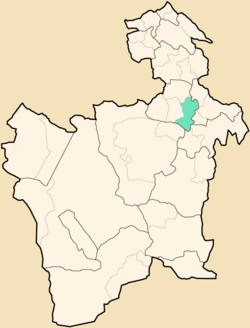 Location within Potosí Department | |
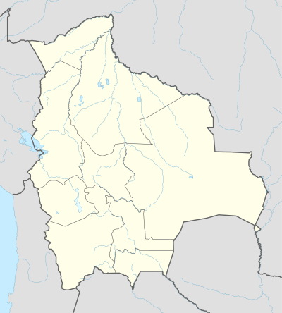 Potosí Municipality Location within Bolivia | |
| Coordinates: 19°35′S 65°43′W | |
| Country | |
| Department | Potosí Department |
| Province | Tomás Frías Province |
| Seat | Potosí |
| Population (2001) | |
| • Total | 145,057 |
| • Ethnicities | Quechua |
| Time zone | UTC-4 (-4) |
Geography
The Potosí mountain range traverses the municipality. Some of the highest mountains of the municipality are listed below:[1][2][3][4][5]
- Achakanani
- Anta Qullu
- Chawpi Urqu
- Jatun Ch'utu
- Jatun Q'asa
- Khari Khari
- Kuntur Qaqa
- Lik'ichiri
- Pari Urqu
- Pä Qullu
- P'ukru
- Qutaña Qullu
- Salla Punta
- Turini
- T'ula Punta
- T'ula Qullu
- Waylla Tira
- Wayra Wasi
- Wayra Wasi (Potosí-Yocalla)
- Yana Qaqa
- Yuraq Q'asa
Subdivision
The municipality consists of the following cantons:
- Chulchucani
- Wari Wari
- Potosí
- Tarapaya
Demographics
The people are predominantly indigenous citizens of Quechua descent.[6]
| Ethnic group | % |
|---|---|
| Quechua | 68.1 |
| Aymara | 2.0 |
| Guaraní, Chiquitos, Moxos | 0.2 |
| Not indigenous | 29.5 |
| Other indigenous groups | 0.2 |
gollark: Maybe someone added one of the sign controllers to the startup list. Maybe stuff got powered off by chunk somehow.
gollark: They power each other on, but otherwise I'm not sure.
gollark: At least the street sign controllers are inevitably and inescapably powered on.
gollark: Really? Hm.
gollark: I'll teleport you into the Site when I join.
See also
References
- Evelio Echevarría, Cordillera de Potosí, Bolivia, The Alpine Journal, 1995
- Bolivian IGM map 1:50,000 Don Diego 6435-I
- Bolivian IGM map 1:50,000 6435-II-1 Potosí (Este)
- Bolivian IGM map 1:50,000 Puna 6434-I
- Bolivian IGM map 1:50,000 Porco 6434-IV
- obd.descentralizacion.gov.bo/municipal/fichas/ (inactive)
External links
| Wikimedia Commons has media related to Potosí. |
Capital: Potosí | ||
| Provinces | 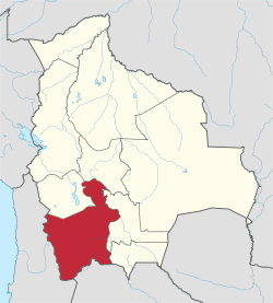 | |
| Municipalities (and seats) |
| |
This article is issued from Wikipedia. The text is licensed under Creative Commons - Attribution - Sharealike. Additional terms may apply for the media files.