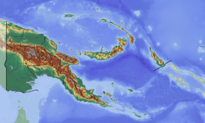
Poroma Rural LLG
Poroma Rural LLG is a local-level government (LLG) of Southern Highlands Province, Papua New Guinea.[1][2]
Poroma Rural LLG | |
|---|---|
 Poroma Rural LLG Location within Papua New Guinea | |
| Coordinates: 6.312147°S 143.633198°E | |
| Country | Papua New Guinea |
| Province | Southern Highlands Province |
| Time zone | UTC+10 (AEST) |
Wards
- 01. Kongu
- 02. Tindom 2
- 03. Mondisarep
- 04. Kar
- 05. Utupia
- 06. Undu Kopa
- 07. Farata
- 08. Kusa
- 09. Det
- 10. Onja-Rundu
- 11. Waramesa
- 12. ombadi
- 13. Kapit/Kum 11
- 14. Purtre/Kum 12
- 15. Wanga
- 16. Mato
- 17. Nenja
- 18. Poroma Station
- 19. Kupipi
- 20. Poroma
- 21. Toiwaro
- 22. Tamenda
- 23. Kunjulu
- 26. Kar 11
gollark: Bell's theorem rules out "local hidden-variables" interpretations of quantum physics, meaning that quantum mechanics cannot, assuming some assumptions, be doing this by storing some extra secret metadata with particles.
gollark: As you will know in time, quantum QM mechanics has "Bell's theorem". This describes some correlations between measurements of entangled particles which QM predicts correctly (based on empirical tests) and classical physics doesn't.
gollark: What? No. That would be stupid.
gollark: Yes.
gollark: Determinism is outdated. I'm a *super*determinist.
References
- "Census Figures by Wards - Highlands Region". www.nso.gov.pg. 2011 National Population and Housing Census: Ward Population Profile. Port Moresby: National Statistical Office, Papua New Guinea. 2014.
- "Final Figures". www.nso.gov.pg. 2011 National Population and Housing Census: Ward Population Profile. Port Moresby: National Statistical Office, Papua New Guinea. 2014.
- OCHA FISS (2018). "Papua New Guinea administrative level 0, 1, 2, and 3 population statistics and gazetteer". Humanitarian Data Exchange. 1.31.9.
- United Nations in Papua New Guinea (2018). "Papua New Guinea Village Coordinates Lookup". Humanitarian Data Exchange. 1.31.9.
This article is issued from Wikipedia. The text is licensed under Creative Commons - Attribution - Sharealike. Additional terms may apply for the media files.